Langtang and Gosainkunda Trek
From (per person)
Langtang and Gosainkunda Trek Highlights
• Walk through Langtang National Park and its diverse ecosystems
• Spot the rare Red Panda in the temperate forests of the lower valley
• Reach Kyanjin Ri (4,773 m) for sweeping views of the Langtang range
• Visit Kyanjin Gompa, an active monastery with a working yak cheese factory
• Stand at the sacred Gosainkunda lakes (4,390 m), holy to Hindus and Buddhists
• Cross Laurebina Pass (4,610 m) and descend into the Helambu foothills
• Pass through Tamang villages with traditional Tibetan Buddhist culture
• See Langtang Lirung (7,227 m) and Ganchenpo (6,387 m) from the trail
• Explore rebuilt Langtang Village, a symbol of post-earthquake recovery
• Trek through rhododendron forests, yak pastures, and glacial moraines
Langtang and Gosainkunda Trek Overview
The Langtang and Gosainkunda Trek form one of Nepal's most complete trekking routes. The combined route covers two distinct trekking areas: the Langtang Valley to the north and the Gosainkunda Lakes region to the west. Both areas lie within easy reach of Kathmandu, making this a practical and rewarding option for trekkers with moderate experience.
The route begins at Syabrubesi (1,460 m), the main roadhead for the Langtang Valley. From here, the trail follows the Langtang Khola upstream through dense forests, small Tamang villages, and open alpine meadows. The mixed temperate forests in the lower valley are prime habitat for the Red Panda, one of the most recognizable animals of the Nepal Himalayas.
The trail passes through Langtang National Park, established in 1976. The park covers 1,710 square kilometers and protects a wide range of ecosystems. Flora ranges from subtropical forest at the lower elevations to alpine tundra near the Tibetan border. Wildlife is diverse, including langur monkeys, Himalayan tahr, and numerous bird species.
Langtang Village (3,400 m) was heavily damaged by the 2015 earthquake and the landslide that followed. The community has since been rebuilt, and trekkers today find functioning teahouses and lodges throughout the settlement. The rebuilt village reflects the resilience of its Tamang residents.
Kyanjin Gompa (3,860 m) serves as the northern endpoint of the Langtang section. The monastery here is one of the oldest in the region and remains active. A long-standing yak cheese factory operates beside the monastery and supplies both visiting trekkers and Kathmandu markets. The area also offers close-up views of the Langtang Lirung Glacier.
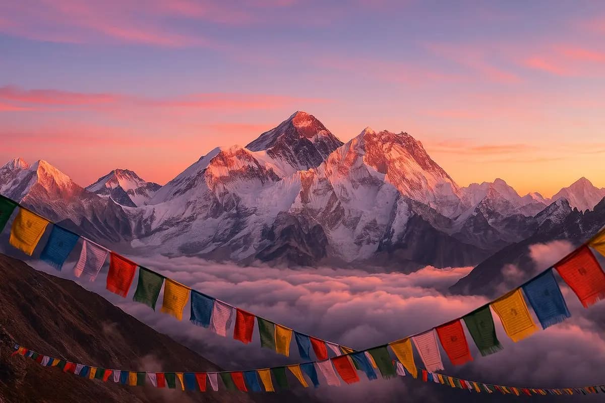
The day hike to Kyanjin Ri (4,773 m) is the highest point of the program. The two-hour ascent from Kyanjin Gompa delivers panoramic views of the full Langtang range, including Langtang Lirung (7,227 m), Ganchenpo (6,387 m), and multiple peaks along the Nepal-Tibet border. This viewpoint is one of the finest accessible on any trekking route in Nepal.
After returning from Kyanjin Gompa, the route descends back through the valley before branching westward at Thulo Syabru. The trail then climbs steeply through rhododendron forests toward the Gosainkunda Lakes region. This transition marks the second phase of the trek, where the landscape becomes more open and the ridges more exposed.
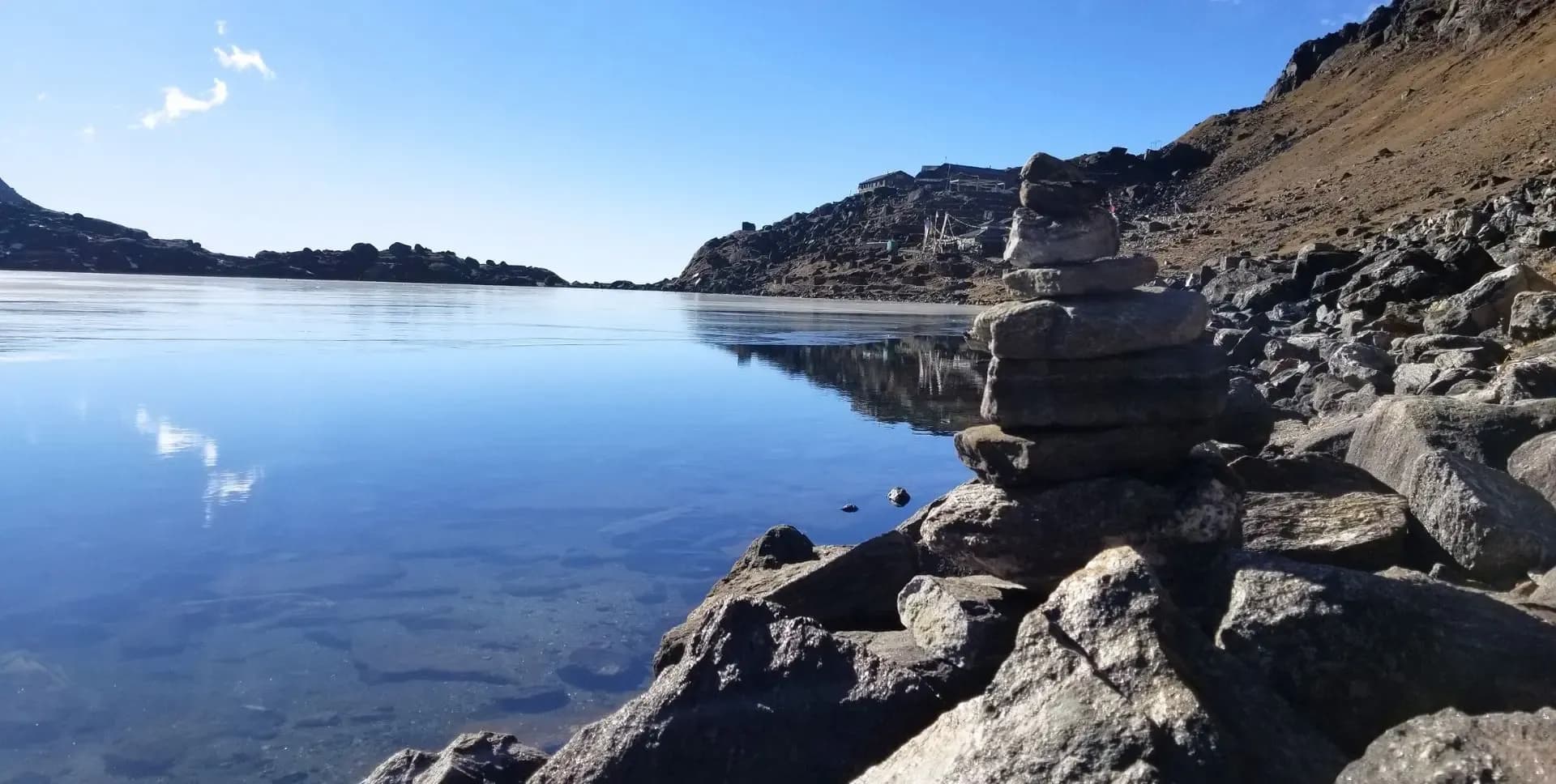
Gosainkunda (4,390 m) is a high-altitude lake of major religious importance. Thousands of Hindu and Buddhist pilgrims visit the lake each year, particularly during the Janai Purnima festival held in August. The lake sits in a glacial basin surrounded by rocky ridges and is visible from the approach trail on the ridge above.
From Gosainkunda, the route crosses Laurebina Pass (4,610 m), the highest point on the return leg of the trek. The descent from the pass is steep and requires care. The trail then moves through Ghopte (3,430 m) and Kutumsang (2,470 m) before reaching Chisapani (2,170 m). From Chisapani, a drive returns trekkers to Kathmandu.
The entire route operates on a teahouse system. Accommodation and meals are available at every stop along the trail. Higher elevations offer more basic facilities, but the essentials remain consistently available. The best trekking seasons are spring (March to May) and autumn (September to November), when skies are clear and temperatures are moderate.
Langtang and Gosainkunda Trek Itinerary
Tap any day to read the full programme.
Arrive at Tribhuvan International Airport in Kathmandu. A representative from Everest Limit meets you at the arrivals hall. A private vehicle then transfers trekkers to hotel in Thamel.
The remainder of the day is free. You can use the time to rest, explore the neighborhood around the hotel, or prepare equipment for the trek ahead. Kathmandu sits at 1,400 m, and the first day allows for initial adjustment to the altitude.
The drive departs early in the morning. The vehicle heads northwest from Kathmandu, climbing to the rim of the valley before passing through the Kakani area. On clear mornings, Ganesh Himal, the Langtang range, and Manaslu are visible from this section of the road.
The route descends to Trisuli Bazaar and then follows the Trisuli River northward through a deep gorge. Beyond Trisuli, the road narrows and passes through Dhunche, the district headquarters and the location of the Langtang National Park entry checkpoint. From Dhunche, a further 15 km of winding road leads down to Syabrubesi.
Syabrubesi (1,460 m) sits at the confluence of the Bhote Kosi and Langtang rivers. The town is a busy staging post with teahouses, shops, and basic amenities. It serves as the starting point for the Langtang Trek. Total driving distance from Kathmandu is approximately 117 km, with a journey time of around 5 to 6 hours. Overnight stay at a teahouse in Syabrubesi.
The first day on the trail starts in Syabrubesi. The route descends briefly to a river-level path before turning north toward the main valley. A suspension bridge crosses the Bhote Kosi, and the trail then climbs steeply through a forested zone above the river.
The lower forest on this section of the Langtang Trek is dense and rich in wildlife. Grey langur monkeys appear frequently in the canopy. A wide variety of bird species inhabit the forest, including laughing thrushes, flycatchers, and sunbirds. This forest zone is recognized as a habitat for the Red Panda. Sightings are possible but depend on luck and timing, particularly in the early morning.
The trail continues to climb through the Langtang Khola gorge, passing a series of waterfalls. A bridge crosses the Langtang Khola to the north bank, and the path climbs again to reach Lama Hotel at 2,470 m. Lama Hotel is a cluster of teahouses in a forest clearing beside the river. Several accommodation options are available at this stop. Approximate trekking time from Syabrubesi is 6 hours, with an elevation gain of approximately 1,010 m.
The trail from Lama Hotel continues upstream along the Langtang Khola. The path climbs steadily as the valley opens. Vegetation transitions from dense forest to more open mixed woodland, and views of the surrounding ridges appear as altitude increases.
Ghora Tabela (2,970 m) lies roughly midway through the day's walk. The name translates as 'horse stable,' reflecting its historical use as a grazing area. Today, a few teahouses and an army checkpost occupy this flat, open area. The northern ridgeline above Ghora Tabela offers the first clear sightings of Langtang Lirung's summit.
Above Ghora Tabela, the valley broadens significantly. The trail passes through Thangshep and enters the wide upper valley, where the Langtang Khola meanders across a gravelly floodplain. Yak pastures appear on both sides of the trail. Dry-stone walls and traditional chortens mark the route into Langtang Village.
Langtang Village (3,400 m) displays classic Tibetan-influenced architecture. Flat-roofed stone houses, mani walls, and carved wooden window frames characterize the settlement. The village was largely destroyed by the 2015 earthquake and the subsequent landslide. Reconstruction has been substantial, and several functioning teahouses and lodges now serve trekkers. Approximate trekking time from Lama Hotel is 6 hours.
The morning walk from Langtang Village to Kyanjin Gompa is a shorter trekking day in terms of distance. However, the altitude gain and mountain scenery make it one of the most rewarding sections of the Langtang Trek.
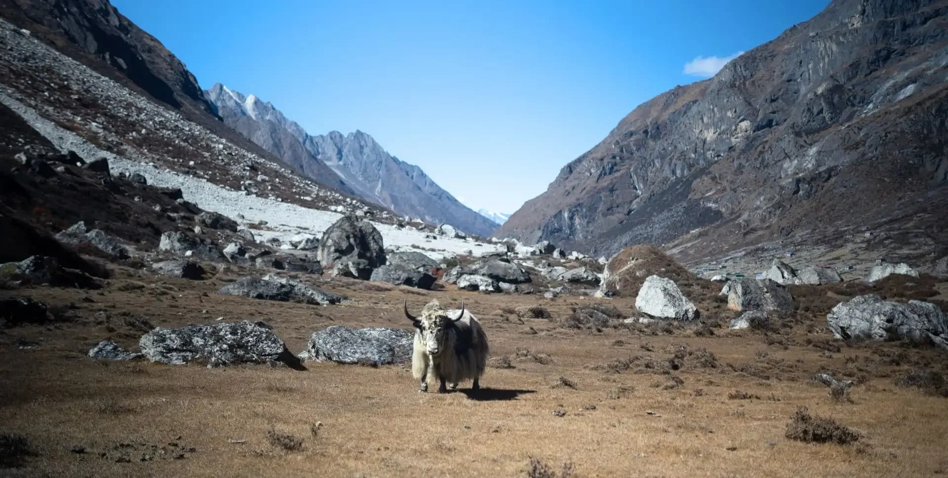
The trail leaves Langtang Village and crosses wide yak pastures. Herds of yaks and naks graze across the valley floor in this section. Streams from lateral glaciers feed into the main river across the floodplain. The Tamang settlements of Mundu and Sindum, both at approximately 3,410 m, lie along the route. Mani walls line the path on both sides.
Ganchenpo (6,387 m) is a strong visual reference to the east throughout this section. A wooden bridge crosses a glacial tributary before the trail climbs onto a moraine above the valley floor. Kyanjin Gompa comes into view as the moraine levels out, framed by the full Langtang range.
Kyanjin Gompa (3,860 m) includes a working monastery, a yak cheese factory, a weather station, and a range of teahouses and lodges. The cheese factory has operated for several decades and produces traditional yak cheese sold to trekkers and exported to Kathmandu. In the afternoon, trekkers can walk toward the Langtang Lirung Glacier at approximately 4,300 m. This one-hour hike provides close access to the glacial ice and the surrounding peaks. Approximate trekking time from Langtang Village is 3 hours.
The day hike to Kyanjin Ri is the highest point reached on the entire program. The ascent begins early in the morning to take advantage of clear light and stable visibility on the surrounding peaks. Trekkers return to Kyanjin Gompa for a second night at this elevation.
The trail starts behind the village and climbs the rocky ridge rising directly above Kyanjin Gompa. The initial section is moderately steep on a well-used path. Higher up, vegetation disappears and the route becomes rocky and fully exposed. The ascent from Kyanjin Gompa to the summit takes approximately 2 hours at a steady pace.
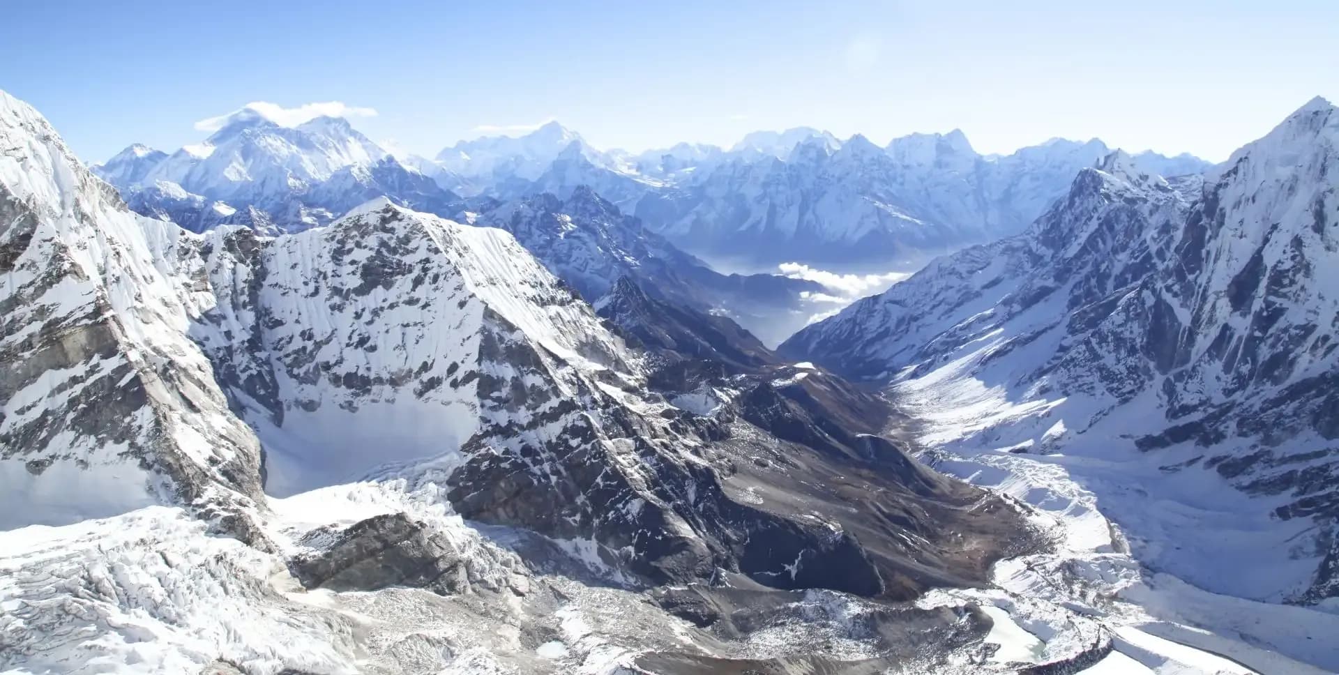
From the summit of Kyanjin Ri (4,773 m), the view covers the full Langtang range from east to west. Langtang Lirung (7,227 m) dominates the northern skyline. Ganchenpo, Langshisa Ri, and multiple peaks along the Tibetan border are clearly visible. The Langtang Valley spreads out below, with the Langtang Khola visible as a silver line across the valley floor. This panoramic viewpoint is widely considered one of the finest accessible from any trekking route in Nepal.
The descent from Kyanjin Gompa retraces the trail used during the ascent on Day 04 and 05. The route passes back through the upper valley, crossing the wooden bridge over the glacial tributary and dropping through the wide yak pastures. The Tamang settlements of Sindum and Mundu are passed again on the way down.
The trail continues through Langtang Village and descends below the broadening upper valley section. As the path re-enters the tree zone below Ghora Tabela, the forest closes in and temperature rises. This forest section offers productive conditions for wildlife observation, including possible Red Panda sightings in the early morning hours.
The trail follows the Langtang Khola back downstream to reach Lama Hotel (2,470 m) by the afternoon. Teahouse accommodation is available at this stop. The forest surrounding Lama Hotel continues to support the biodiversity of the lower valley. Approximate trekking time for this descent is 5 to 6 hours.
Today's route branches away from the main Langtang Valley trail. From Lama Hotel, the path descends to the river level before crossing a bridge over the Langtang Khola. The trail then climbs westward, away from the valley floor, toward the ridge above.
The route passes through mixed forest and continues climbing to reach a junction near the main trail. From here, the path heads uphill to the left toward Thulo Syabru. The climb is steady, passing through woodland and crossing small streams.
Thulo Syabru (2,250 m) is a Sherpa village perched on a prominent ridge above the Langtang Valley. The village offers views back across the valley toward the Langtang range. Teahouse accommodation is available here. Approximate trekking time from Lama Hotel is 5 hours. This stop marks the transition point between the Langtang Valley section and the Gosainkunda section of the program.
The day begins with a steep uphill trail above Thulo Syabru. The trail follows the upper route toward Dursagang (2,550 m) before the gradient eases through dense rhododendron forest. During spring, the rhododendrons are in full bloom along this section.
The route reaches Chandan Bari (3,250 m), which includes Sing Gompa, a notable landmark in this area. The trail then cuts across the top ridge and continues through forested terrain, crossing the head of a valley before reaching the final ridge section.
The upper section of the trail climbs steeply along the ridge. The path then crosses behind the ridge through deep forest before emerging onto a saddle at Chalang Pati (3,380 m). A final ascent leads to Laurebina (3,960 m). From this point, wide mountain views open up, including Annapurna, Manaslu, Ganesh Himal, and Langtang Lirung. Overnight stay at a teahouse at Laurebina. Approximate trekking time from Thulo Syabru is 6 to 7 hours.
The trail from Laurebina continues high on the ridge above 4,000 m. The first lake to appear is Saraswati Kunda, visible below the trail. The path then crosses a rocky spur before a second, larger lake comes into view: Bhairab Kunda.
The trail keeps to the ridge before dropping approximately 20 meters to the shore of Gosainkunda (4,390 m), the third and largest of the Gosainkunda lakes. The lake is a site of deep religious significance for both Hindus and Buddhists. A black rock at the center of the lake is venerated as a manifestation of Lord Shiva.
Gosainkunda draws thousands of pilgrims annually, particularly during Janai Purnima in August. The lake sits in a wide glacial basin surrounded by rocky ridges. Teahouse accommodation is available near the lakeshore. The setting is austere but striking, with high-altitude light reflecting off the water. Approximate trekking time from Laurebina is 3 hours.
This is the most demanding day of the second half of the trek. The route begins by skirting the north shore of Gosainkunda before ascending on a rough trail marked with rock cairns. Three small lakes are passed on the way to Laurebina La pass (4,610 m), reached in approximately one hour from Gosainkunda.
The descent from Laurebina La is steep and requires careful footwork. The trail drops sharply at first before easing toward Bheda Goth (4,100 m). The route then descends along the valley to Phedi (3,500 m). The trail through this gorge section runs along steep left-hand flanks with a significant drop to the right, and caution is advised.
From Phedi, the trail ascends to a ridge across the valley on a steep, rough path. After gaining the ridge, the route descends through a brief section of forest and climbs in and out of ravines before reaching a final spur overlooking the overnight destination. Ghopte (3,430 m) lies below this spur. Teahouse accommodation is available here. Approximate trekking time for the day is 6 to 7 hours.
The landscape shifts from this point onward. The high Himalayan peaks are now behind, replaced by long-ranging foothills and forested ridges. The route from Ghopte drops steeply and passes through alpine terrain, continuing up and down across moraines below the 1992 crash site of a Thai Airways aircraft.
The trail merges with the Helambu Circuit at a junction below Tharepati. The lunch stop at Tharepati (3,510 m) is reached in approximately 2.5 hours from Ghopte. Tharepati sits on a prominent ridge crest with wide views of the surrounding foothills.
After Tharepati, the route arches to the right and descends along rhododendron-strewn meadows and streams. The well-defined path returns to the ridge and drops down stone steps before reaching a trail junction near Mangengoth (3,150 m). From there, the trail continues to descend toward a wide hillside and enters the Tamang village of Kutumsang (2,470 m), set on a saddle in the ridge with terraced fields on either side. Approximate trekking time from Ghopte is 7 to 8 hours.
The trail from Kutumsang follows the ridge crest toward Gul Bhanjyang (2,142 m). Beyond the village, the route climbs back to the ridge and alternates between the left and right flanks. The path eventually passes through oak forest leading to Namche Danda (2,453 m).
A long descent down stone step leads to Chipling (2,165 m). The trail zigzags through terraced fields before reaching Thana Bhanjyang (1,780 m). At the next trail junction, trekkers take the middle branch toward Pati Bhanjyang (1,768 m). Beyond the village, the route turns right and makes a steep 400-meter ascent to Chisapani (2,170 m).
Chisapani is a well-known viewpoint on the Shivapuri Nagarjun National Park ridge. Morning views from here include a broad panorama of the Himalayan range, including peaks visible from Langtang to Everest on clear days. From Chisapani, a vehicle transfers trekkers back to Kathmandu. Total trekking time from Kutumsang is approximately 7 hours.
The final day of the Langtang Trek and Gosainkunda Trek program concludes with departure from Kathmandu. A private vehicle transfers you to Tribhuvan International Airport based on your flight schedules.
Trekkers should plan to arrive at the airport with adequate time for international check-in procedures. The program ends formally at the point of airport transfer.
Langtang and Gosainkunda Trek Route Map
Route Map
Altitude Profile
Inclusions
• Private airport transfers in Kathmandu (arrival & departure)
• Private jeep transfer from Kathmandu to Syabrubesi and from Chisapani to Kathmandu
• 2 nights at a 3-star Kathmandu hotel (twin-share, bed & breakfast)
• 11 nights twin-share lodge accommodation during the trek
• Full-board meals throughout the trek (breakfast, lunch, dinner, tea & coffee)
• Drinking water and hot water for bottle refills at all lodge stops
• All required trekking permits (Langtang National Park Entry Permit & TIMS Card)
• Senior English-speaking, government-licensed lead guide, fully covered (wages, meals, accommodation & insurance)
• Assistant guide for every 4 clients, fully covered
• One porter per 2 clients (max 15 kg/client), fully covered
• Emergency medical kit throughout the trek
Exclusions
• International Airfare to/from Kathmandu
• Nepal entry visa fee
• Personal travel, medical & emergency evacuation insurance (mandatory; arrange prior to departure)
• Lunch & dinner in Kathmandu
• Additional Kathmandu nights beyond the itinerary (available on request)
• Single room supplement or forced single room charges, where applicable
• Personal trekking gear & clothing (sleeping bag, boots, trekking poles, down jacket, etc.)
• Alcoholic beverages, specialty hot drinks & bottled/canned drinks during the trek
• Lodge extras charged locally: hot showers, battery charging & Wi-Fi
• Any personal expenses not listed under inclusion
• Guide & porter gratuities (recommended: USD 100/guide, USD 65/porter — at client's discretion)
Date & Price
Want a Private or Tailored Trip?
Book on your own dates, bring a private group, or adjust the itinerary. Our team replies within 24 hours.
Reviews
Write a review
No reviews yet. Be the first to share your experience.
Gallery
No gallery images available.
From (per person)
People also viewed