Annapurna Circuit Trek
From (per person)
Annapurna Circuit Trek Highlights
• Cross the legendary Thorong La Pass at 5,416 m (17,768 ft), one of the world's highest trekking passes
• Visit Tilicho Lake at 4,820 m (15,814 ft), one of the highest lakes on Earth
• Hike to Milarepa Cave at 4,100 m (13,450 ft), a historic Tibetan Buddhist meditation site
• Trek through the scenic Marsyangdi Valley and Kali Gandaki gorge
• Explore Manang village, the cultural heart of the Annapurna Circuit Trek
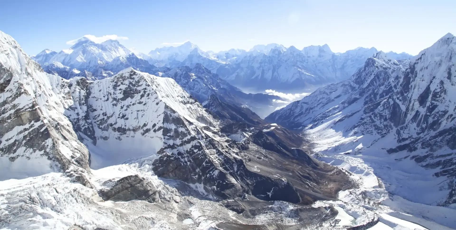
• View iconic Himalayan peaks including Annapurna II, III, IV, Gangapurna, Dhaulagiri, and Tilicho Peak
• Discover ancient gompas, mani walls, and Tibetan Buddhist culture along the route
• Visit Muktinath, a sacred pilgrimage site for both Hindus and Buddhists
Annapurna Circuit Trek Overview
The Annapurna Circuit Trek is one of the most celebrated long-distance treks in the world. It circles the entire Annapurna mountain range in northern Nepal. The route crosses multiple ecological zones, from subtropical lowlands near Besishar to the high-altitude plateau of Manang. Along the way, trekkers pass through Gurung, Manangi, and Thakali villages, each having its own language and traditions.
This 15-day program follows an optimized route that combines the classic Annapurna Trek with two rewarding side trips. The first is a hike to Milarepa Cave above Manang. The second is a multi-day extension to Tilicho Lake via Siri Kharka and Tilicho Base Camp. These additions make the itinerary one of the most complete versions of the circuit available.
The highest and most demanding point of the Annapurna Circuit Trek is the Thorong La Pass, sitting at 5,416 m (17,768 ft). Trekkers cross this pass on Day 11 before descending to the holy town of Muktinath and driving to Jomsom. Proper acclimatization days are built into the program, particularly around Manang, to reduce the risk of altitude sickness. Trekkers then fly from Jomsom to Pokhara, where they have time for rest and sightseeing before returning to Kathmandu.
The total trek distance covers roughly 160 to 180 kilometers of mountain trails, jeep tracks, and high passes. The program is best suited for trekkers with moderate to good physical fitness. Prior trekking experience at altitude is an advantage, especially for crossing the Thorong La Pass and following the exposed trails near Tilicho Lake.
Annapurna Circuit Trek Itinerary
Tap any day to read the full programme.
You will arrive in Kathmandu and transfer to their hotel. The day allows time to rest, organize gear, and complete any remaining permit paperwork. Kathmandu serves as the logistical starting point for the Annapurna Circuit Trek.
Kathmandu sits at 1,400 m (4,593 ft) and offers a comfortable base for final preparations. You may use the afternoon to visit gear shops in Thamel or attend a briefing with their guide or trekking company.
The day begins with an early drive from Kathmandu to Besishar, a town located at 760 m (2,493 ft) in the Marsyangdi Valley. Besishar is the administrative center of Lamjung District and serves as the gateway to the Annapurna Circuit. The drive from Kathmandu to Besishar takes approximately six hours along the Prithvi Highway via Dumre.
From Besishar, a jeep continues up the Marsyangdi Valley through a series of villages and river crossings. The road passes through Bhulbule, Ngadi, Jagat, Dharapani, Bagarchap, and Danagyu. These are all parts of the lower circuit trail that trekkers once walked on foot. Today, the improved jeep road allows the full approach to Chame in a single day.
Chame sits at 2,670 m (8,760 ft) and is the district headquarters of Manang. The town has lodges, shops, a bank, and an ACAP office. Trekkers will notice the terrain shifting here, with pine forests and the first views of the high Himalayan peaks. Annapurna II and Lamjung Himal become visible from Chame on a clear day.
The trail leaves Chame and follows the right bank of the Marsyangdi River through tall pine forests. The path passes through Talekhu and the small village of Bhratang before entering a dramatic narrow gorge. The steep canyon walls and roaring river make this one of the most scenic sections of the lower Annapurna Trek.
Beyond the gorge, the valley opens into a wide, barren amphitheater. This stark landscape is called Paungi Danda, or the Gateway to Heaven, by the local Gurung people. The slope rises sharply from the river and is considered sacred in Gurung tradition. The geological formation is dramatic and unlike anything seen earlier on the route.
Continuing past Dukhure Pokhari, a forest lake, the trail reaches the Pisang area. The path crosses to Upper Pisang at 3,300 m (10,827 ft), set on a ridge above the valley. Upper Pisang offers sweeping views of Annapurna II and Pisang Peak (6,091 m). The village has a traditional gompa at the top of the settlement, completed in 2005, with elaborate Buddhist murals and statues.
The trail from Upper Pisang enters the broad Manang Valley, now clearly in the rain shadow of the Annapurna range. Vegetation is sparse, and the landscape takes on a more arid character. The path passes through the small village of Humde, which has a short airstrip that used to serve occasional flights.
From Humde, the route continues past the villages of Chindi and Munji. A sign near Munji points south to Milarepa Cave, which trekkers will visit on Day 5. Just ahead lies Braga, a cluster of medieval stone houses piled against a rocky slope. Braga's ancient gompa, built high above the village, is one of the oldest and most significant monasteries on the Annapurna Circuit.
Manang village sits at 3,540 m (11,614 ft) and is the largest settlement in the upper Annapurna region. It has over 20 lodges, several cafes and bakeries, an ACAP information center, and a Himalayan Rescue Association (HRA) medical post. The HRA runs afternoon lectures on altitude sickness, which trekkers are encouraged to attend. Manang offers panoramic views of Annapurna II, III, IV, Gangapurna, and Tilicho Peak.
This acclimatization day combines a rest at altitude with an active hike to Milarepa Cave at 4,100 m (13,450 ft). Milarepa was a revered Tibetan saint and poet who is believed to have meditated in this cave during the 12th century. The site holds deep significance in Tibetan Buddhist culture and attracts both trekkers and pilgrims.
The hike crosses the Marsyangdi River and climbs the slope on the left bank above Manang. The ascent takes two to three hours and rewards trekkers with excellent views of the Annapurna peaks and Manang Valley below. Reaching the cave provides an important physiological benefit: climbing high and sleeping low is the standard acclimatization principle at altitude.
You will return to Manang for the night. The descent is straightforward. The afternoon is free to explore old Manang village, visit Braga Gompa, or browse the local shops. Staying a second night in Manang is an important step before the higher terrain ahead. The body needs time to adjust to altitudes above 3,500 m before attempting the Thorong La Pass.
The route now diverges from the main Annapurna Circuit to take the Tilicho Lake extension. The trail crosses the Jharsang Khola suspension bridge west of Manang and follows the Khangsar Khola valley. This path heads toward Khangsar village, the last permanent settlement before Tilicho Lake.
Khangsar sits at approximately 3,735 m (12,250 ft) and has two lodges. The surrounding fields grow wheat and barley during the short growing season. Beyond Khangsar, the trail climbs steeply through scrubland before leveling near a small chorten. The Thare Gompa, a remote, yellow-roofed shrine, appears on the slope ahead.
Siri Kharka sits at 4,070 m (13,353 ft) and offers two lodges with satellite television in the dining area. The location provides outstanding views of the Annapurna massif, including Gangapurna and Kangsar Kang (Roc Noir). Siri Kharka serves as the overnight base for the approach to Tilicho Base Camp and the lake itself. Trekkers should rest well and hydrate before the next two demanding days.
The trail from Siri Kharka to Tilicho Base Camp is one of the most challenging sections of the Annapurna Trek. The path crosses a steel suspension bridge and climbs steeply beyond it. The trail then traverses a series of exposed scree slopes, rock outcrops, and steep descents over a distance of roughly six kilometers.
The most technical section is a one-kilometer landslide zone where the trail narrows to a thin ledge above a deep river gorge. The path is unstable in places, and loose stones are common. Trekkers must move carefully and avoid the area in wet or snowy conditions. Guides recommend crossing this section early in the day before afternoon wind and temperature changes.
Tilicho Base Camp is located at 4,150 m (13,615 ft) and has two basic lodges. The setting is dramatic, with Kangsar Kang and the Grand Barrier filling the view to the west. The Grand Barrier is the long ridge that connects the main Annapurna range to the Tilicho massif. Trekkers should take the afternoon to rest and acclimatize before the ascent to the lake on Day 8.
This is the longest and most demanding day of the Tilicho extension. Trekkers depart early from base camp, ford a stream, and begin the climb up a long spur. The trail switches sides at the top of the spur and traverses the main ridge. The views open up dramatically from this point, with the entire Annapurna wall visible from Gangapurna to Kangsar Kang.
The trail continues past alpine scrub and onto bare, rocky terrain. A series of switchbacks totaling more than 200 m of elevation gain marks the final approach. The trail then narrows and follows the edge of the slope before reaching an uneven plateau. Tilicho Lake appears suddenly at the end of the plateau at 4,820 m (15,814 ft).
Tilicho Lake is approximately four kilometres long and sits in a dramatic glacial basin surrounded by snowcapped peaks. Maurice Herzog first documented the lake in 1950, calling it the Great Ice Lake. The waters are often partially frozen, even in late spring and autumn. There is a basic teahouse on the shore. After spending time at the lake, trekkers descend back to Siri Kharka for the night. Total walking time for the day is approximately nine to eleven hours.
From Siri Kharka, the route rejoins the main Annapurna Circuit heading toward Thorong La Pass. A signposted junction less than 300 m from Siri Kharka marks the turn toward Yak Kharka. The trail descends through juniper and alpine scrub, following the Jharsang Khola valley in a generally northward direction.
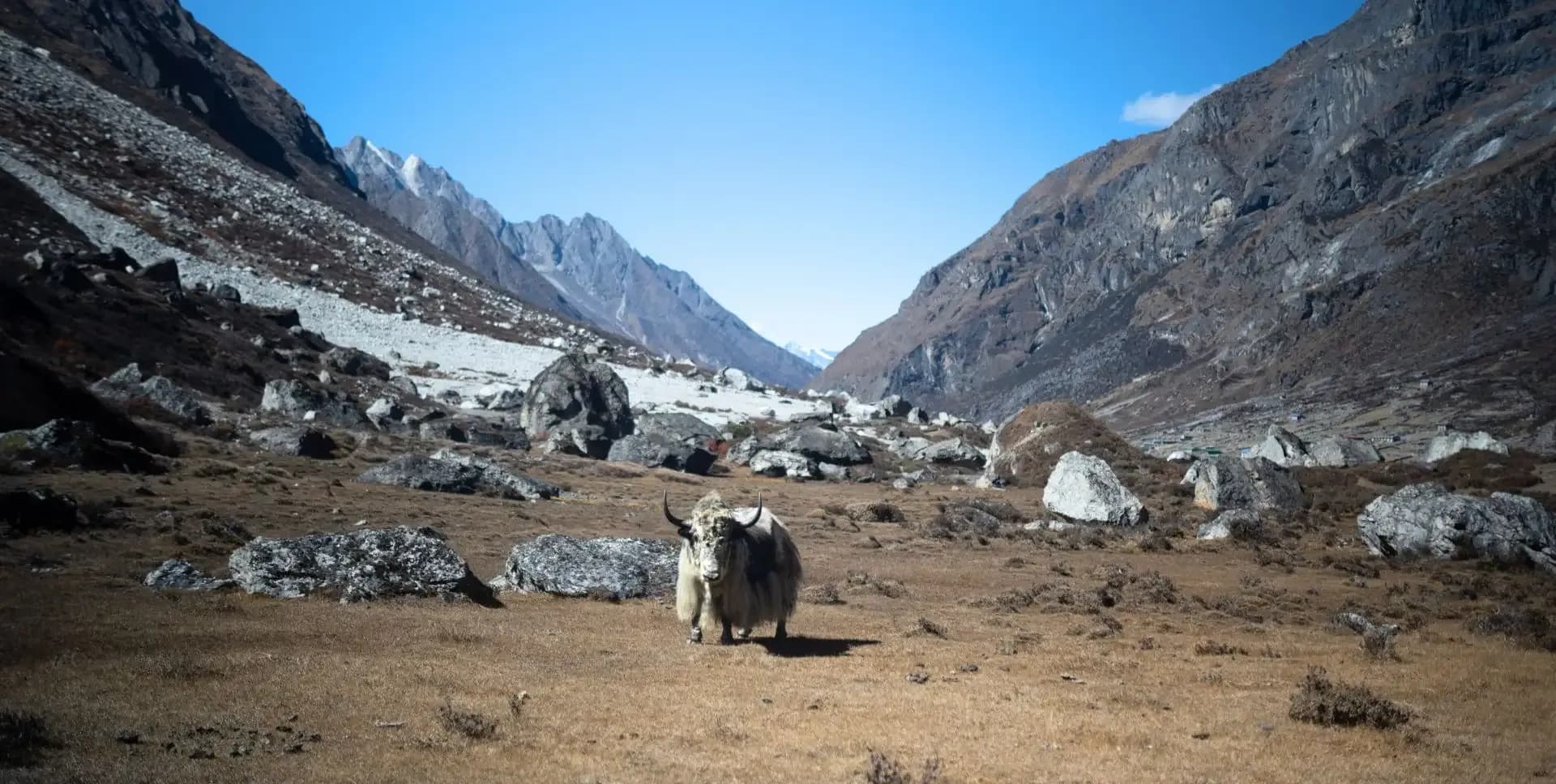
The path passes the Old Khangsar settlement on a ridge top. This abandoned village, at around 4,100 m, once served as a seasonal home for Manang herders. Today the stone huts are used mainly as cattle sheds. From Old Khangsar, the trail rounds a large open pasture where yaks, horses, and sheep often graze. Lammergeiers, large vultures common to the Himalayas, circle overhead searching for food.
The trail descends and crosses the Jharsang Khola over a log bridge before climbing to the Ghyangchang plateau. It then meets the main circuit trail and follows it to Yak Kharka at 4,020 m (13,189 ft). Yak Kharka means yak pasture in Nepali. The settlement has several lodges and serves as a key stopover before the high push toward Thorong La. Lodges here have warm dining rooms with charcoal heaters under the tables.
The trail from Yak Kharka passes the yak pasture and continues along the Khone Khola river valley. The landscape becomes increasingly barren and alpine. Views of the Annapurna range to the south and the Chulu peaks to the east accompany trekkers throughout the morning walk.
The path crosses a suspension bridge about 1.5 km from Yak Kharka and passes through Letdar at 4,200 m (13,775 ft). Letdar has a few lodges and is a suitable rest stop for tea. The trail continues past another yak pasture and a small pond. The canyon deepens as the river narrows through a rugged gorge. A steel hanging bridge marks a key crossing, followed by a steep 70 m climb to a ridge called Deurali.
Thorong Phedi appears at the base of the climb to Thorong La Pass, sitting at 4,430 m (14,534 ft). The name phedi means foot of the hill in Nepali. Two lodges operate here, the larger having roughly 40 rooms. Accommodation books up quickly during peak trekking season, so advance reservation from Manang is advisable. Meals are available but slightly more expensive than in lower villages. Trekkers must rest early and prepare for a predawn start on Day 11.
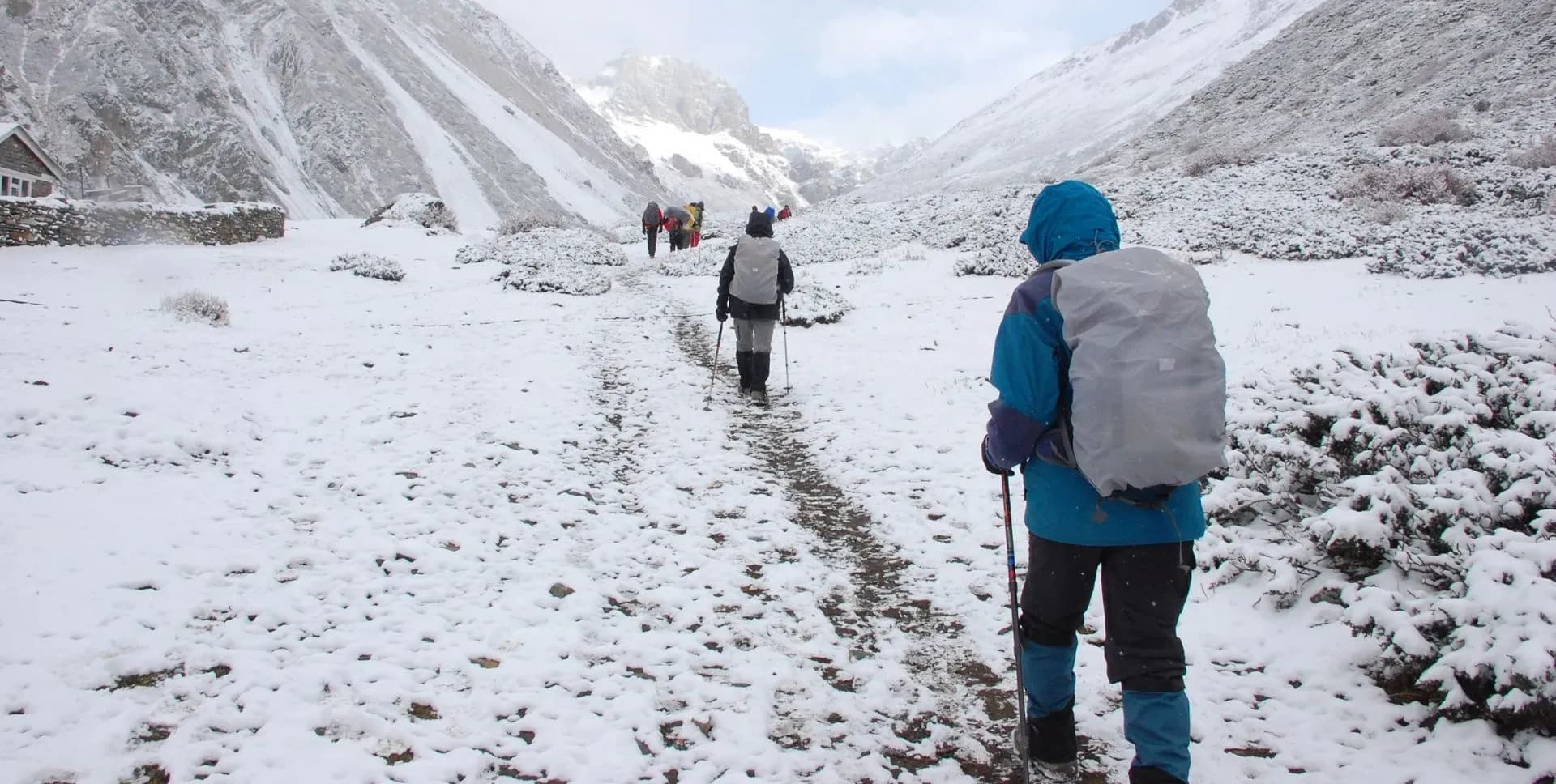
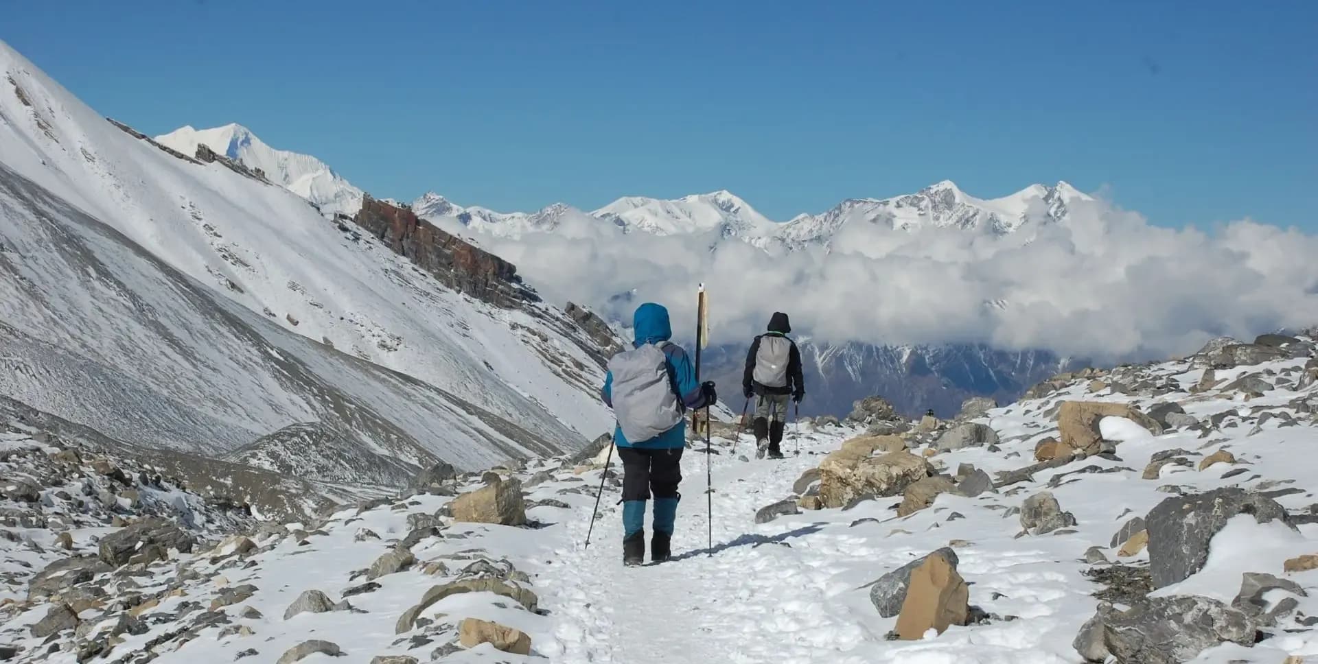
Today is the most important and physically demanding day of the entire Annapurna Circuit Trek. You rise well before sunrise and begin the ascent to Thorong La Pass at 5,416 m (17,768 ft). An early start, around 5:00 to 6:00 am, is essential. High winds typically develop after late morning and can make the upper pass dangerous.
The ascent begins with a very steep scree slope directly above Thorong Phedi. The trail zigzags up through a series of switchbacks. Thorong High Camp sits at 4,860 m (15,940 ft), approximately ninety minutes above Phedi. Some trekkers choose to spend the night at High Camp, though this is not recommended as a substitute for the Phedi stopover. A small teahouse at 5,120 m (16,800 ft) offers the last rest point before the summit.
The summit of Thorong La Pass is marked by prayer flags, a mani wall, and stone cairns. The altitude of 5,416 m places at 609 m above Mont Blanc, the highest peak in the Alps. The descent to Muktinath is long and steep, covering over 1,600 m of elevation loss. A seasonal settlement called Chabarbu at 4,210 m offers tea and rest midway. Muktinath temple complex sits at 3,760 m (12,336 ft) and is a major pilgrimage site for both Hindus and Buddhists. After visiting the temples, drive to Jomsom at 2,720 m (8,924 ft), the district headquarters of Mustang, for the night.
The morning begins at Jomsom Airport, a short distance from the lodge area. Jomsom has a functional airport with regular Twin Otter flights connecting to Pokhara. Flights typically depart early in the morning before winds pick up in the Kali Gandaki valley. The flight takes approximately 20 to 25 minutes and offers aerial views of the Dhaulagiri and Annapurna ranges.
Pokhara sits at 822 m (2,697 ft) on the shores of Phewa Lake and is the second largest city in Nepal. The city is the commercial gateway to the Annapurna region and has a well-developed tourist infrastructure. After the austerity of the high mountains, Pokhara provides a comfortable setting for rest and recovery. Trekkers check into their hotel and have the remainder of the day free.
Pokhara's lakeside area offers restaurants, cafes, souvenir shops, and gear stores. The Annapurna and Machhapuchhre peaks remain visible from the city on clear days. Trekkers may wish to celebrate the completion of the Annapurna Trek with a meal out or a short walk along Phewa Lake in the evening.
Pokhara offers numerous sightseeing options for trekkers with a free day. The Annapurna Circuit Trek ends here logistically, but the city itself has much to offer. Key sites include Phewa Lake, Davis Falls, Gupteshwor Cave, the International Mountain Museum, and the World Peace Pagoda on the ridge above the lake.
Phewa Lake is the most popular destination in Pokhara. Trekkers can rent boats and paddle to the Tal Barahi Temple on a small island in the lake's center. The northern shore of the lake provides some of the best views of the Annapurna and Machhapuchhre peaks. Early mornings are best for clear mountain visibility.
The International Mountain Museum on the southern edge of the city documents the history of Himalayan exploration, with exhibits on major peaks including Annapurna I, Dhaulagiri, and Manaslu. Trekkers interested in the cultural heritage of the Annapurna region will find the museum informative. The day in Pokhara also allows time for a massage, medical check-in, or laundry before the return to Kathmandu.
Trekkers take an early morning flight from Pokhara to Kathmandu. The flight takes approximately 25 to 30 minutes and provides views of the Himalayan range on clear days. On arrival in Kathmandu, trekkers transfer to their hotel and have the remainder of the day for shopping, sightseeing, or rest.
Kathmandu's Thamel area has numerous shops selling traditional Nepali handicrafts, pashmina, thangka paintings, and trekking gear. Trekkers may also wish to visit heritage sites such as Boudhanath Stupa or Pashupatinath Temple, both close to the airport. The evening is a good time to reflect on the completed Annapurna Circuit Trek over a meal in one of Thamel's many restaurants.
The program concludes on Day 15. Trekkers depart Kathmandu or extend their stay in Nepal depending on personal travel plans. Airport transfers and final logistics are handled by the trekking operator.
The Annapurna Circuit Trek covering Thorong La Pass and the Tilicho Lake extension represents one of the most complete and rewarding trekking experiences available in the Himalayas. The route combines high-altitude challenges, cultural immersion, and dramatic landscape changes across 14 active days of travel. Trekkers leave with a comprehensive experience of the Annapurna region from subtropical lowlands to glacial high passes.
Annapurna Circuit Trek Route Map
Route Map
Altitude Profile
Inclusions
• Private airport transfers in Kathmandu (arrival & departure)
• 2 nights at a 3-star Kathmandu hotel (twin-share, bed & breakfast)
• 2 nights at a 3-star Pokhara hotel (twin-share, bed & breakfast)
• Flights from Jomsom to Pokhara and onward to Kathmandu with standard baggage allowance
• Private transfer from Kathmandu to Besisahar, and Jeep transfer from Besisahar to Chame
• Shared local transfer from Muktinath to Jomsom
• 10 nights twin-share lodge accommodation during the trek
• Full-board meals throughout the trek (breakfast, lunch, dinner, tea & coffee)
• Drinking water and hot water for bottle refills at all lodge stops
• All required trekking permits (Annapurna Conservation Area & TIMS Card)
• Senior English-speaking, government-licensed lead guide, fully covered (wages, meals, accommodation & insurance)
• Assistant guide for every 4 clients, fully covered
• One porter per 2 clients (max 15 kg/client), fully covered
• Emergency medical kit throughout the trek
• Supplemental oxygen, mask & regulator for emergency use
Exclusions
• International Airfare to/from Kathmandu
• Nepal entry visa fee
• Personal travel, medical & emergency evacuation insurance (mandatory; arrange prior to departure)
• Lunch & dinner in Kathmandu and Pokhara
• Optional sightseeing in Kathmandu and Pokhara
• Additional hotel nights beyond the itinerary (available on request)
• Single room supplement or forced single room charges, where applicable
• Personal trekking gear & clothing (sleeping bag, boots, trekking poles, down jacket, etc.)
• Alcoholic beverages, specialty hot drinks & bottled/canned drinks during the trek
• Lodge extras charged locally: hot showers, battery charging & Wi-Fi
• Any personal expenses not listed under inclusion
• Guide & porter gratuities (recommended: USD 150/guide, USD 100/porter — at client's discretion)
Date & Price
Want a Private or Tailored Trip?
Book on your own dates, bring a private group, or adjust the itinerary. Our team replies within 24 hours.
Reviews
Write a review
No reviews yet. Be the first to share your experience.
Gallery
No gallery images available.
From (per person)
People also viewed