Pharchemo Peak Climbing
From (per person)
Pharchemo Peak Climbing Highlights
• Summit Pharchemo Peak (6,187 m / 20,299 ft) via the classic northwest ridge route.
• Cross Tashi Laptsa Pass (5,755 m / 18,871 ft), a demanding high-altitude glacier pass linking Rolwaling to Khumbu.
• Trek through the remote Rolwaling Valley, one of Nepal's least-visited trekking regions.
• Day hike to Yalung Ri Base Camp (4,900 m / 16,067 ft) with panoramic views of Gaurishankar Himal and surrounding peaks.
• Descend through the iconic Khumbu Valley via Thame, Namche Bazaar, and Lukla.
• Enjoy 360-degree summit views of Gaurishankar Himal, Everest, Makalu, Melungtse, and the broader Himalayan range.
Pharchemo Peak Climbing Overview
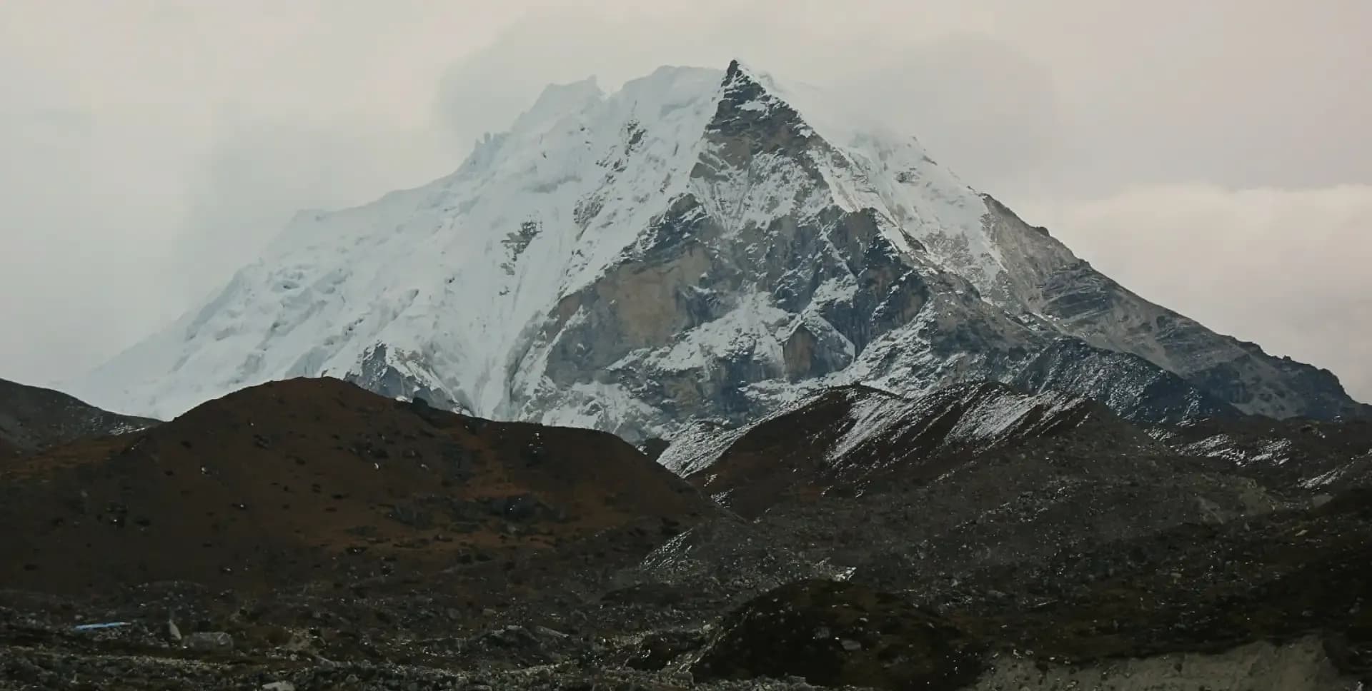
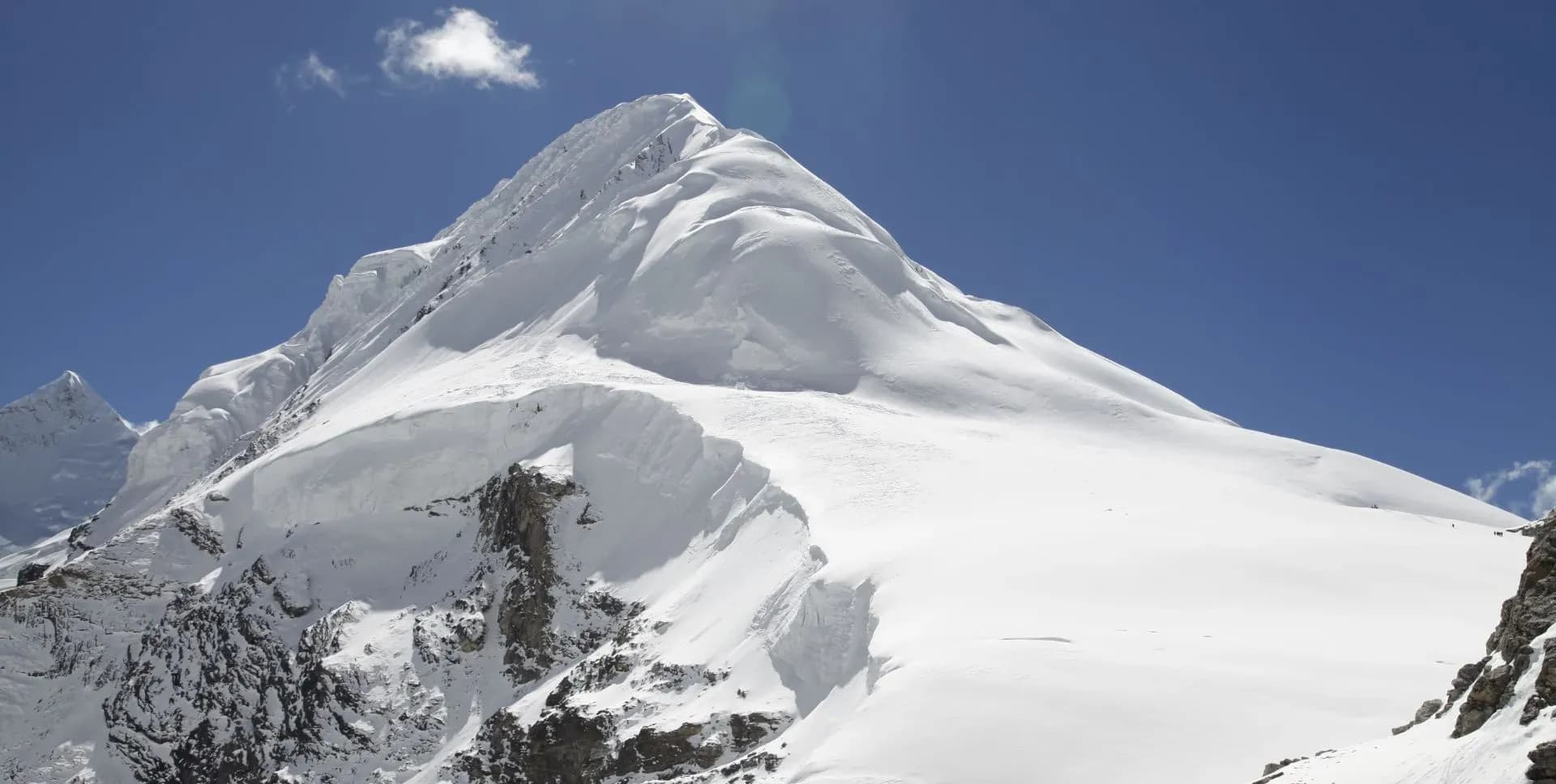
Pharchemo Peak (6,187 m / 20,299 ft) stands to the south of Tashi Laptsa Pass. The pass connects the Rolwaling Valley to the Khumbu region in eastern Nepal. The peak was first climbed in 1955 via the northwest ridge. That same ridge remains the standard route for summit attempts today.
The Rolwaling Valley is one of Nepal's most remote and least-visited trekking regions. It shares a northern border with China and is separated from the Khumbu by Tashi Laptsa Pass to the east. The valley has changed very little over centuries and retains a strong Sherpa cultural identity. Local oral traditions often refer to the Yeti, which is closely associated with this valley.
Several major peaks rise within the Rolwaling Valley. These include Gaurishankar Himal, Pharchemo Peak, Ramdung Go, Chobutse, Nachugo, Khangtari, and Bamongo. Tsho Rolpa Lake occupies the heart of the upper valley and ranks among Nepal's largest glacial lakes. The lake is actively monitored due to glacial melt and the associated risk of glacial lake outburst floods downstream.
The Rolwaling Valley supports rich biodiversity despite its altitude. Rhododendron and mixed alpine forest cover the lower slopes in thick layers. White langur monkeys, snow leopards, and yaks inhabit different elevation zones throughout the region. Seasonal wildflowers bloom from June through July, adding color to the lower valley terrain.
This 18-day program begins with a road journey from Kathmandu to Chet-Chet before the first trek to Simigaon. The route then continues through Kyalche, Beding, and Na Gaon in the Rolwaling Valley. An acclimatization rest day at Beding and a day hike to Yalung Ri Base Camp build altitude readiness. The program then advances into the high glacier zone above Tsho Rolpa Lake.
From Na Gaon, the trail climbs through Chu Gyma and Zabuwa before the technical crossing of Tashi Laptsa Pass. The pass sits at 5,755 m (18,871 ft) and requires a pre-dawn departure to allow safe crossing. Navigation through the Drolambu Icefall and glacier demands careful movement guided by experienced leaders. Tashi Phuk, the base camp for Pharchemo Peak, is reached on the far side of the pass.
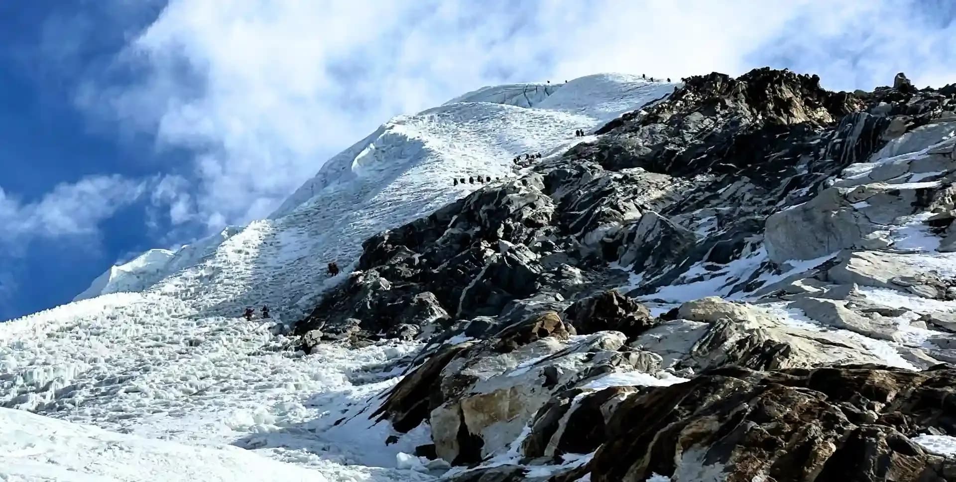
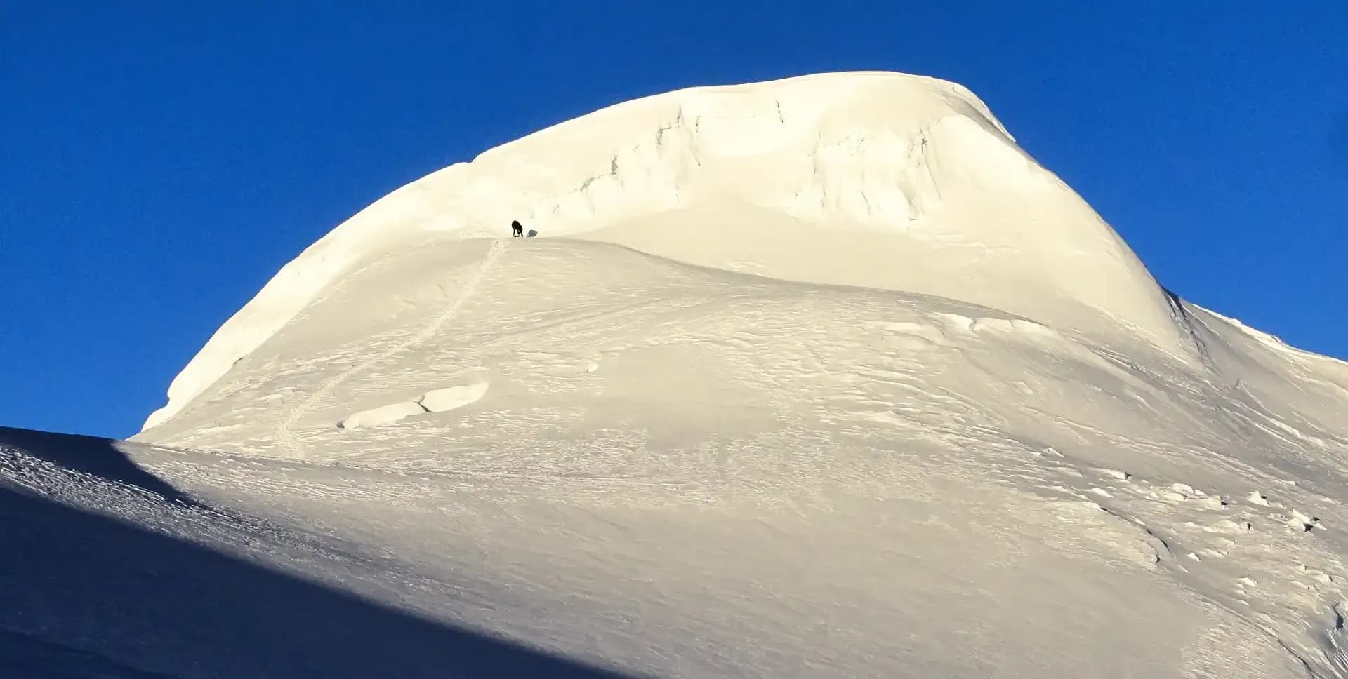
The summit push starts before dawn from Tashi Phuk base camp. The climbing route follows the northeast icefall before ascending the northwest ridge to the summit. Technical equipment including crampons, harness, alpine boots, and an ascender is required throughout the climb. The average climbing time from base camp to the summit is approximately four hours.
Pharchemo Peak's summit delivers 360-degree views of Gaurishankar Himal, Everest, Makalu, and Melungtse. Additional peaks across the Khumbu and Rolwaling ranges are visible on a clear day. After the summit, the group descends to Ngole and then exits via the Khumbu Valley. The program ends with a flight from Lukla to Kathmandu.
This program suits trekkers with prior experience above 5,000 m. Experience using technical climbing gear including a harness, crampons, and an ascender is an advantage. A climbing briefing and full equipment review are conducted at base camp before the summit day. The optimal climbing windows for this route are March to May and September to November.
Pharchemo Peak Climbing Itinerary
Tap any day to read the full programme.
Arrive at Tribhuvan International Airport in Kathmandu. A program representative meets the group and transfers them to the hotel by private vehicle. The rest of the day is free for personal preparation and rest.
An evening briefing covers the full 18-day schedule, safety protocols, and daily objectives. The guide team reviews the complete route, weather considerations, and climbing equipment requirements. Trekkers confirm personal gear and receive a final packing checklist before early departure the next morning.
The group departs Kathmandu by road around 5:30 AM. The route heads east through Dhulikhel and continues through Dolakha district to the trailhead at Chet-Chet. The drive covers approximately 180 km and takes 8 to 9 hours depending on road and traffic conditions.
From Chet-Chet (1,377 m / 4,517 ft), the trek begins on the right-hand trail just beyond the suspension bridge. The path climbs steeply through stone steps cut into the hillside. This initial ascent sets the tone for the elevation gain that characterizes the Rolwaling Valley route.
The path continues upward through forested terrain to the Sherpa village of Simigaon. Walking time from Chet-Chet to Simigaon is approximately 3 hours. Simigaon (2,036 m / 6,679 ft) offers lodging accommodation and serves as the first overnight stop on the trek.
The third day begins with a descent from Simigaon through a canopy of rhododendron forest before the trail climbs steadily toward Surmuche. At the junction near Riku village, the route bears right, bypassing the suspension bridge, and continues onward to Surmuche — a well-placed rest stop and the standard lunch point for trekking groups on this section.
After lunch, the path winds upward through dense woodland along stone steps, gradually deepening into thicker forest as the altitude rises. Passing through Kyalche along the way, the trail eventually reaches Dongang after approximately 6 to 7 hours of total walking time from Simigaon.
Dongang sits at 2,791 m amid dense forest that is rich with birdlife and, during the spring months of March through May, alive with rhododendrons blooming in vivid shades of red and pink across the surrounding hillsides — one of the most rewarding natural spectacles the lower Rolwaling Valley has to offer.
The trail ascends from Dongang to the bank of the Rolwaling Khola. After a steel box bridge crossing, the route climbs sharply to Thangdingma, where a small teashop provides a lunch stop. The terrain beyond this point transitions markedly.
Past Thangdingma, vegetation thins and the valley becomes drier and more exposed. The trail stays close to the Rolwaling Khola as it winds through the upper valley section. Nyamare, a village heavily damaged by the 2015 earthquake, passed along the route.
From Nyamare, a wooden bridge crossing leads to a gentle climb toward Changmi Kha. A traditional Kani gateway and the valley's largest tree mark the final stretch before Beding. The gateway is a spiritual and cultural landmark in the Rolwaling Valley.
Beding (3,740 m / 12,270 ft) is the main permanent settlement in the Rolwaling Valley. The village has a strong mountaineering tradition and is widely known as a home to Everest summiteers. Lodge accommodation and basic facilities are available for trekking groups.
A full rest day at Beding (3,740 m / 12,270 ft) is built into the program to support gradual altitude adjustment. The body responds best to altitude gains when given time to stabilize at a consistent elevation. Light walks around Beding are recommended while avoiding strenuous activity.
Beding's monastery is a central point of religious and cultural life in the Rolwaling Valley. Many households in the village include members who have summited Everest or other major Himalayan peaks. This connection to high-altitude climbing is deeply embedded in the community.
Proper rest and hydration at Beding directly affect performance in the high glacier sections ahead. No altitude gain is made on this day. The acclimatization rest is especially important before the approach to Tsho Rolpa Lake and the Tashi Laptsa Pass section.
The trail from Beding climbs steadily upstream along the Rolwaling Khola. Numerous gentle switchbacks follow the left bank of the river toward the upper valley. The walk to Na Gaon takes approximately 3 to 4 hours and involves consistent but manageable altitude gain.
Along the route, trekkers pass the largest boulder in the Rolwaling Valley, marked with prayer flags. A rock painting of Guru Rinpoche appears on the uphill trail to the left. The Tsho Rolpa Lake basin and the upper cirque of the valley come into view as the trail gains elevation.
Na Gaon (4,180 m / 13,714 ft) sits at the upper edge of the inhabited valley. The settlement offers clear views of Pharchemo Peak and Gaurishankar Himal to the northeast. Na Gaon is the primary base camp for day hikes and acclimatization activities in this part of the Rolwaling Valley.
After breakfast at Na Gaon, cross the box bridge and follow the trail on the right side of the Rolwaling Khola. The path heads toward the Tsho Rolpa basin before branching upward toward Yalung Ri. The ascent becomes steep and sustained from this junction.
The climb to Yalung Ri Base Camp (4,900 m / 16,067 ft) takes 3 to 4 hours from Na Gaon. The trail gains altitude quickly and delivers expanding views of the Rolwaling peaks. Pharchemo Peak, Chobutse, Cho Oyu, and Gaurishankar Himal are visible on clear days.
A small stone porter shelter marks Yalung Ri Base Camp. This is the turnaround point for the day hike. The return to Na Gaon follows the same trail and takes approximately 2 to 3 hours.
The Yalung Ri hike follows the principle of climbing high and sleeping low. Reaching 4,900 m while overnighting at 4,180 m builds altitude tolerance for the demanding terrain above Tsho Rolpa Lake. Trekkers overnight again at Na Gaon after completing the hike.
Leaving Na Gaon, the trail crosses the river and turns south. The first notable stop is Yersa at Sangma, the last seasonal herder settlement in this part of the valley. Beyond this point, the trail enters uninhabited terrain and remains so until the Khumbu side.
After a wooden bridge crossing, the path climbs through glacial moraine toward the Tsho Rolpa dam area. Tsho Rolpa Lake (also known as Cho Pokhari) is one of Nepal's largest glacial lakes, located in the heart of the Rolwaling Valley. The lake has expanded substantially due to glacial melt and is actively monitored by Nepal's Department of Hydrology.
Camp at Chu Gyma (4,560 m / 14,960 ft) is established to the south of Tsho Rolpa Lake. Views of Chobutse, Dragker-Go, and surrounding peaks are clear from this position. All accommodation beyond Na Gaon is in expedition tents managed by the crew.
The route from Chu Gyma leads into the Drolambu Icefall, situated directly below Tashi Laptsa Pass. This is one of the most demanding trekking days in the program due to the fully glaciated terrain. The route crosses areas with no permanent paths or habitation.
The trail navigates through an eroded glacial valley shaped by centuries of ice movement. At this altitude, the landscape is entirely barren with exposed rock, ice debris, and moraine fields. Careful footing and close guidance from the team are essential throughout.
Zabuwa (5,400 m / 17,716 ft) is the final camp before the Tashi Laptsa Pass crossing. The position is exposed, and weather can change rapidly at this elevation. The guide team assesses weather patterns and team fitness on this evening before the high-altitude push to the pass.
The group departs Zabuwa well before sunrise. The trail crosses the glacier and ascends a natural spur that allows access to the upper glaciated zone. Headlamps and careful route-finding by guides are essential in the pre-dawn conditions.
The ascent to Tashi Laptsa Pass (5,755 m / 18,871 ft) takes approximately 4 hours. The pass is marked by a cairn and prayer flags at the top. Views span both the Rolwaling Valley and the Khumbu region, covering a broad arc of the Himalayan range.
Tashi Laptsa Pass is considered one of the more demanding high-altitude crossings in Nepal. The sustained glacier travel at significant elevation demands both physical endurance and technical awareness. The crossing completes the link between the Rolwaling Valley and the Everest region.
After reaching the pass, the group descends the Khumbu side and passes a glaciated pond before arriving at Tashi Phuk. Tashi Phuk serves as the base camp for the Pharchemo Peak summit attempt.
The crossing of Tashi Laptsa Pass marks the geographic boundary between two distinct Himalayan regions. The Rolwaling Valley is quiet and largely unchanged by modern tourism. The Khumbu side has well-developed infrastructure and steady trekking traffic throughout both peak seasons.
The summit push begins well before dawn from Tashi Phuk base camp. The climbing route follows the northeast icefall from the pass area and ascends the northwest ridge toward the summit. Crevassed glacier sections and exposed seracs require rope management and full use of technical gear.
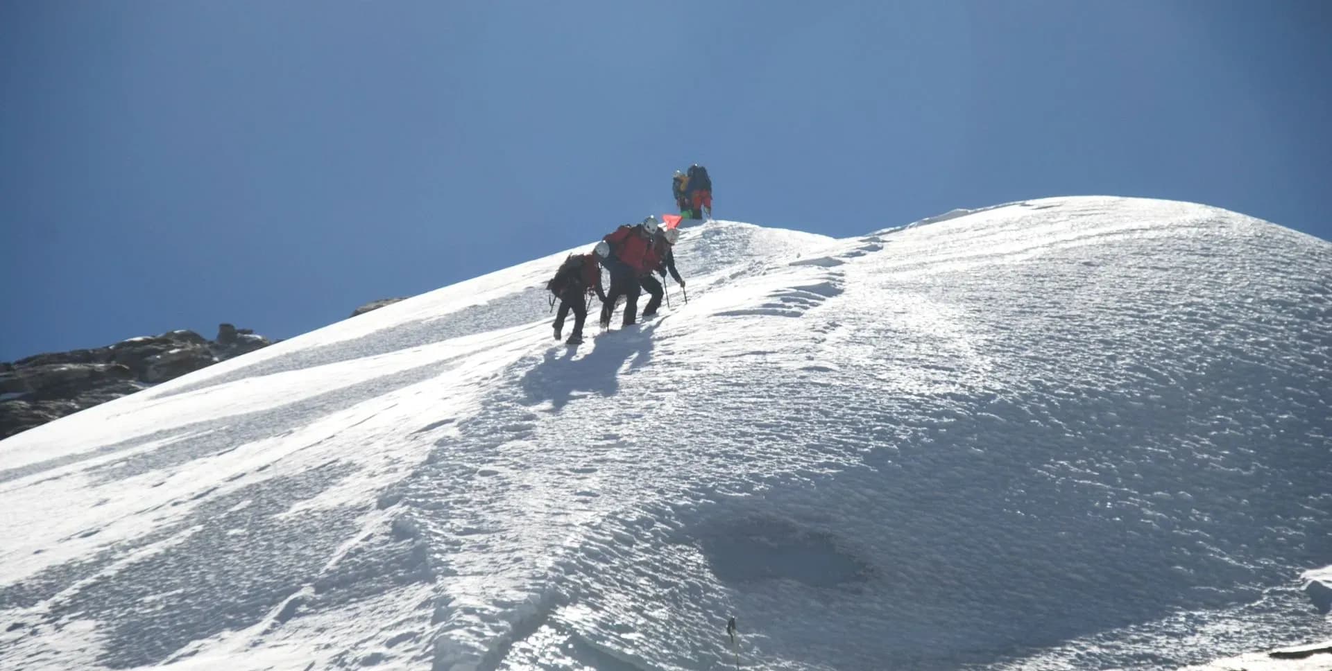
All climbers use crampons, harness, alpine boots, and an ascender throughout the ascent. The average climbing time from base camp to the summit of Pharchemo Peak (6,187 m / 20,299 ft) is approximately 5 hours.
The summit of Pharchemo Peak delivers 360-degree views of Gaurishankar Himal, Everest, Makalu, and Melungtse. The Khumbu and Rolwaling ranges stretch across the horizon in all directions. The summit view is one of the most expensive in the region for a peak of this technical grade.
After the summit, the team descends by the same route back to Tashi Phuk for a rest and meal. The group then continues the descent to Ngole (4,250 m / 13,943 ft) for the overnight stay. The total descent from the summit area to Ngole takes approximately 3 hours.
This day is built into the program as a buffer for potential summit-day delays. High winds, reduced visibility, or team fitness concerns may require postponing the summit attempt by one day. If the summit is completed on Day 11 as planned, this day becomes a recovery and buffer day.
On a buffer day, the team rests at the current location or continues the descent at a relaxed pace. The guide team makes the decision based on current weather and physical condition of the group. No structured activities are assigned on this contingency day.
Building a contingency day into the schedule reflects the practical demands of high-altitude mountaineering. Weather windows at 6,000 m are unpredictable and narrow. The buffer ensures the program remains achievable without requiring compromises on safety or preparation.
Leaving Ngole, the trail heads east across snow slopes and descends toward the Thame River valley below. The path passes through dispersed temporary herder settlements at Thengpo. Khumbu mountain views accompany most of this descent.
The trail descends steadily through open terrain before entering the main Thame valley. Thame (3,800 m / 12,467 ft) is a well-established Sherpa village and one of the gateway communities for the Everest region. It is also the starting point for the Everest Three High Passes Trek.
Thame has a traditional monastery, several lodge options, and basic services. The village receives consistent trekking traffic during peak seasons. The shift from the remote Rolwaling terrain to the more developed Khumbu trail infrastructure is noticeable from this day onward.
The trail from Thame descends gradually through rhododendron forest and small Sherpa settlements. Most of the route follows a descending trail through the Khumbu Valley. Walking time from Thame to Namche Bazaar is approximately 4 to 5 hours.
Namche Bazaar (3,440 m / 11,286 ft) is the main commercial and cultural hub of the Khumbu region. The town offers lodges, restaurants, communication services, and a variety of trekking shops. It is an important acclimatization stop for groups heading toward Everest Base Camp.
Namche Bazaar hosts a weekly Saturday market and has several Buddhist monasteries within the surrounding area. Viewpoints above the town offer clear sightlines to Everest, Ama Dablam, and nearby peaks. Trekkers can restock, rest, and communicate with home before the final descent to Lukla.
The final trekking day follows the Dudh Kosi River downstream from Namche Bazaar to Lukla. The trail descends consistently along the river corridor with a gradual and steady gradient. Teahouse lunch stops are available at regular intervals along the established path.
Lukla (2,845 m / 9,334 ft) is reached after a short final climb to the airstrip level. Tenzing-Hillary Airport at Lukla is the primary exit point from the Khumbu region by air. Flight check-in and luggage confirmation take place at the guesthouse this evening.
The final evening in Lukla marks the last night on the trail. The guide team and porters gather with the group for an informal celebration of the completed program. Trekkers are advised to rest and prepare for the early morning flight to Kathmandu.
An early morning flight departs Lukla for Kathmandu. Flights at Tenzing-Hillary Airport are weather-dependent and most reliable during the early morning window. Trekkers should be ready for departure ahead of the scheduled time.
On arrival at Tribhuvan International Airport, the group transfers to the hotel by private vehicle. The remainder of the day is free for rest, cultural sightseeing, or shopping. Kathmandu offers a range of dining and heritage sites for the final city day.
This day is held in reserve for delays or cancellations of the Day 16 Lukla flight. Mountain weather frequently disrupts Lukla operations, particularly during the shoulder seasons. If Day 16 proceeds without issue, this day is free time in Kathmandu.
Optional sightseeing activities in Kathmandu are available on this day. Key heritage sites include Pashupatinath Temple, Boudhanath Stupa, Swayambhunath, and Patan Durbar Square. Shopping for handicrafts and souvenirs in the Thamel district is another popular option for trekkers.
Depart Kathmandu for their international flights. A program representative assists with the airport transfer and check-in process. Transfer timing is coordinated based on each trekker's individual flight schedule.
Summit certificates and all climbing permit documentation are collected before departure from the hotel. International flights depart from Tribhuvan International Airport in Kathmandu. Day 18 marks the formal conclusion of the 18-day Pharchemo Peak Climbing program.
Pharchemo Peak Climbing Route Map
Route Map
Altitude Profile
Inclusions
• Private airport transfers in Kathmandu (arrival & departure)
• Private jeep transfer from Kathmandu to Chet-Chet
• One-way flight from Lukla to Kathmandu with standard baggage allowance
• 3 nights at a 3-star Kathmandu hotel (twin-share, bed & breakfast)
• 11 nights twin-share lodge accommodation during the trek
• 3 nights camping between Na Gaon and Ngole, including the Tashi Laptsa Pass crossing
• High-altitude tents (twin-share), kitchen, dining & toilet tents for the camping section
• Full-board meals throughout the trek and at camp (breakfast, lunch, dinner, tea & coffee)
• Drinking water and hot water for bottle refills at all lodge and camp stops
• All required permits (Gaurishankar Conservation Area, Special Restricted Area, Sagarmatha National Park, Khumbu Pasang Lhamu Rural Municipality & TIMS Card)
• Pharchemo Peak climbing permit and garbage deposit fees
• Fixed rope installation from Tashi Laptsa Pass (Pharchemo Base Camp) to the summit, including all necessary ropes, ice screws & snow pickets
• Senior English-speaking, climbing guide per 2 clients, fully covered (wages, meals, accommodation & insurance)
• Assistant climbing guide for every 2 additional clients, fully covered
• 1 cook and required kitchen helpers for the camping section, fully covered
• One porter per 2 clients (max 15 kg/client) plus one additional porter per 3 clients for climbing equipment, fully covered
• Emergency medical kit throughout the trek and climb
• Supplemental oxygen, mask & regulator for emergency use
Exclusions
• International Airfare to/from Kathmandu
• Nepal entry visa fee
• Personal travel, medical & emergency evacuation insurance (mandatory; arrange prior to departure)
• Lunch & dinner in Kathmandu
• Additional Kathmandu nights beyond the itinerary (available on request)
• Single room supplement or forced single room charges, where applicable
• Personal trekking & climbing gear (sleeping bag, boots, trekking poles, down jacket, harness, crampons, etc.)
• Alcoholic beverages, specialty hot drinks & bottled/canned drinks during the trek
• Lodge extras charged locally: hot showers, battery charging & Wi-Fi
• Pharchemo Peak summit bonus of USD 150 per client for lead/assistant climbing guides
• Any personal expenses not listed under inclusion
• Gratuities for guides, cook, kitchen helpers & porters (recommended: USD 200/guide, USD 100/cook, USD 80/kitchen helper, USD 150/porter — at client's discretion)
Date & Price
Want a Private or Tailored Trip?
Book on your own dates, bring a private group, or adjust the itinerary. Our team replies within 24 hours.
Reviews
Write a review
No reviews yet. Be the first to share your experience.
Gallery
No gallery images available.
From (per person)
People also viewed