Gokyo Lakes Trek
From (per person)
Gokyo Lakes Trek Highlights
• Fly into Lukla (2,845 m), gateway to the Khumbu region and the Everest Panorama.
• Explore Namche Bazar (3,440 m), the hub and cultural heart of the Khumbu Valley.
• Hike to Hotel Everest View (3,880 m) for a stunning Everest View from a high-altitude vantage point.
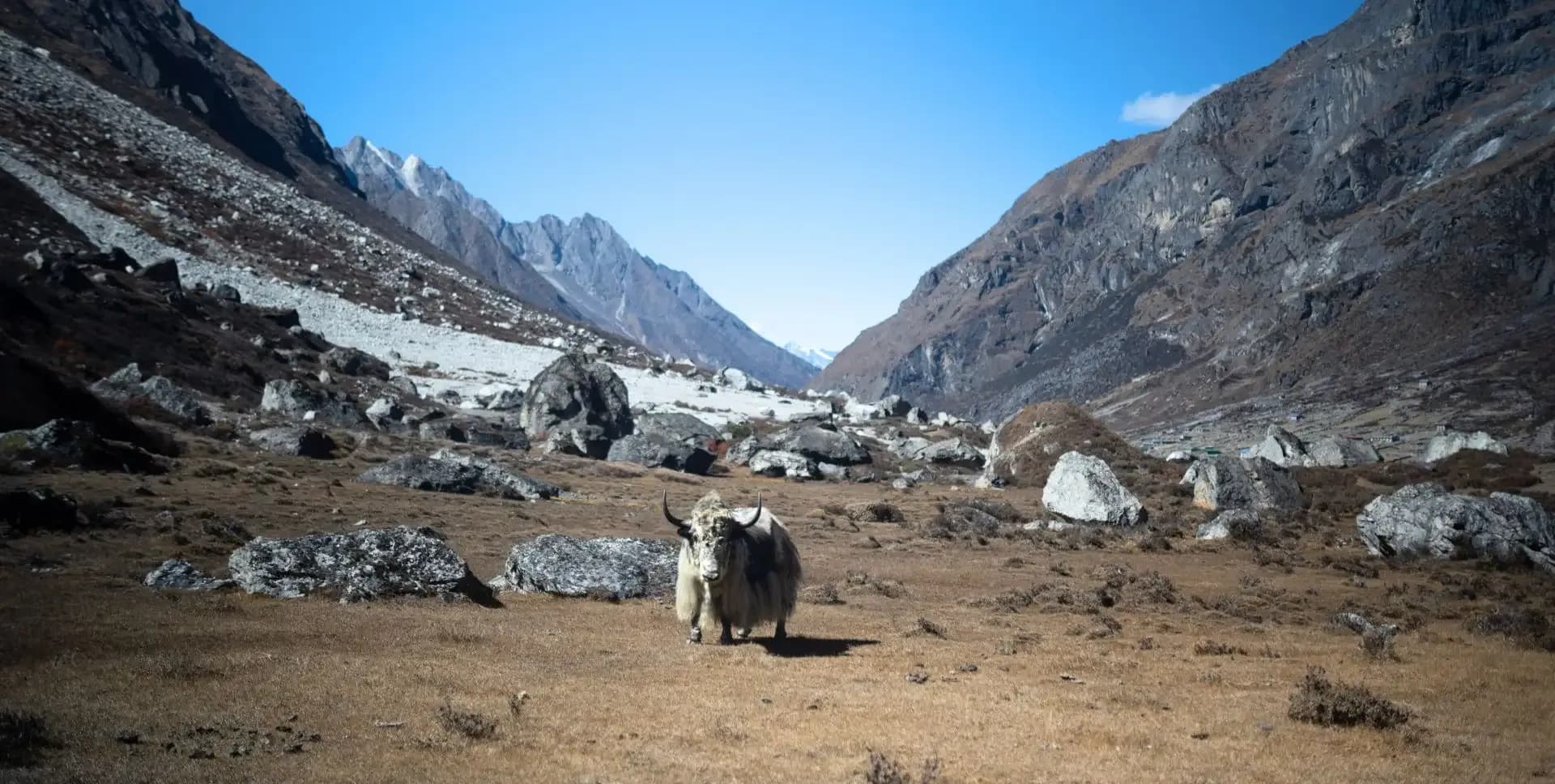
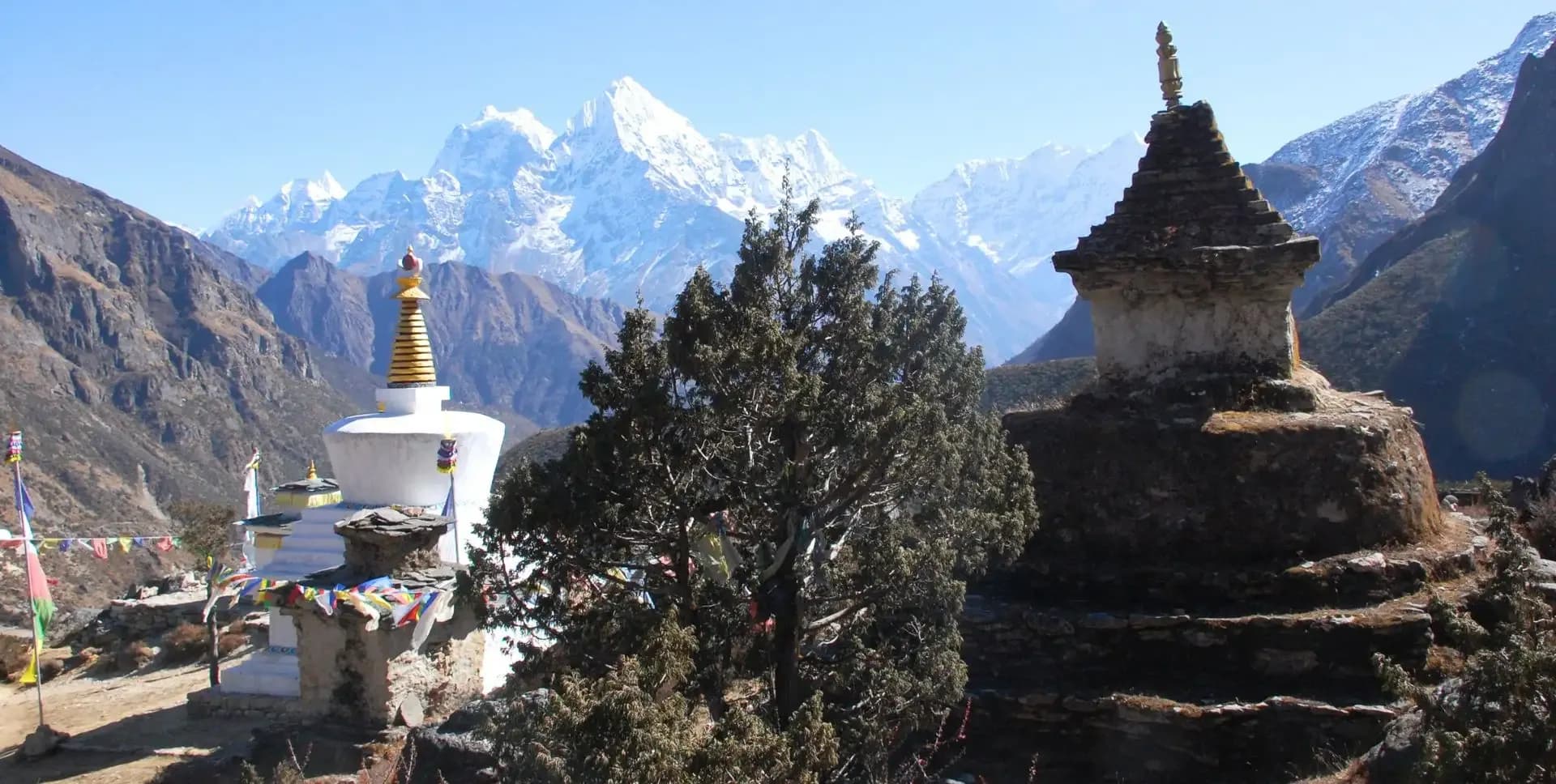
• Trek through the Dudh Koshi valley, passing mani walls, Buddhist chortens, and yak herders.
• Visit the sacred Gokyo Lakes (4,790 m), a Ramsar-listed wetland in the Himalaya.
• Climb Gokyo Ri (5,357 m) for a sweeping Everest Panorama of four 8,000-meter peaks.
• View the Ngozumpa Glacier, the largest glacier in the Himalaya.
• Pass through dense rhododendron, magnolia, and juniper forests on forest trails.
• Experience authentic Sherpa culture, local teahouses, and high-altitude village life.
Gokyo Lakes Trek Overview
The Gokyo Lakes Trek is one of Nepal's most scenic high-altitude routes. It takes you deep into the Khumbu region of the Nepalese Himalaya. The trail leads through ancient Sherpa villages, alpine forests, and open glacial valleys. The trek reaches its highest point at Gokyo Ri (5,357 m), offering one of the finest Everest Panorama views in the region.
The route begins with a flight from Ramechhap to Lukla, followed by a gradual ascent through the Dudh Koshi valley. You pass through well-known settlements such as Phakding, Namche Bazar, Dole, and Machhermo. Each stop presents a distinct character and altitude, ensuring a steady and safe acclimatization profile. The trail also passes alongside the Ngozumpa Glacier, the largest glacier in the Himalayan range.
Gokyo Lakes sit at 4,790 m and form a chain of six glacial lakes. They are listed under the Ramsar Convention as a protected wetland of international importance. The main lake, Dudh Pokhari, lies directly below Gokyo Ri. From the summit of Gokyo Ri, you can see Everest (8,849 m), Lhotse, Makalu, and Cho Oyu, four of the world's fourteen 8,000-meter peaks. This Everest Viewpoint rivals any viewpoint in the Khumbu.
The descent follows a different trail through the Sherpa village of Phortse Tenga and back to Namche Bazar. This variation offers fresh scenery and reduces trail congestion. The total trekking distance covers approximately 130 kilometers over 14 days.
The trek is suitable for fit and healthy individuals with prior hiking experience. No technical climbing skills are required. You should be capable of walking six to eight hours per day at altitude on uneven mountain terrain. The ideal trekking seasons are pre-monsoon (March to May) and post-monsoon (September to November). During these windows, skies are generally clear and visibility from Gokyo Ri is at its best for Everest Panorama photography and peak identification.
Gokyo Lakes Trek Itinerary
Tap any day to read the full programme.
You arrive at Tribhuvan International Airport in Kathmandu (1,400 m). A representative meets each arrival and transfers the group to the hotel. The remainder of the day allows time to rest and recover from travel.
In the evening, the trek guide conducts a pre-departure briefing. This covers the route, daily distances, altitude concerns, and packing requirements.
The day begins with an early morning drive from Kathmandu to Ramechhap (474 m), approximately four to five hours by road. You board a short mountain flight from Ramechhap to Lukla (2,845 m). The flight offers aerial views of the Himalayan foothills and takes roughly 20 minutes.
At Lukla, the trek officially begins. The trail descends from the airstrip and heads north through the Dudh Koshi river valley. The route passes mani stone walls, carved boulders, and several small hamlets. The landscape transitions from terraced farmland to sub-alpine woodland as you descend toward Phakding (2,610 m). The walk to Phakding takes approximately two and a half hours and follows a relatively easy gradient.
Today's trail follows the Dudh Koshi river northward through mixed forests of rhododendron, magnolia, and giant fir. The route crosses several suspension bridges over the Dudh Koshi before reaching the village of Jorsalle (2,805 m), after entering Sagarmatha National Park at Monjo.
Beyond Jorsalle, the trail climbs steeply through forest to reach Namche Bazar (3,440 m). Namche Bazar serves as the administrative and commercial center of the Khumbu region. The town features a weekly Saturday market, teahouses, restaurants, gear shops, and a small museum. The ascent from the river valley to Namche takes approximately two hours and is the most strenuous climb of the lower section. Total trekking time is around five hours.
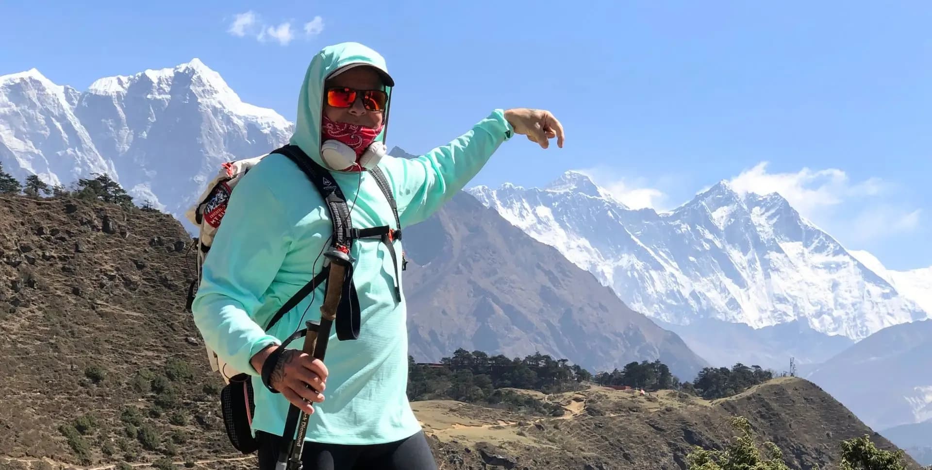
This rest day at Namche Bazar (3,440 m) allows the body to adjust to the increased altitude before continuing higher. You take an acclimatization hike up the ridge above town to Hotel Everest View (3,880 m). From here, the Everest View is clear on good weather days, with Ama Dablam, Thamserku, and Kongde also visible.
Back in Namche Bazar, you can visit the Sherpa Culture Museum, the Edmund Hillary School, and the local market. The town offers a range of teahouses and lodges for an afternoon rest. The acclimatization day at Namche Bazar is a standard and medically recommended step on all Khumbu treks above 3,500 m.
The trail leaves Namche Bazar and climbs gradually along a ridge toward Mong La (3,973 m). Mong La sits on a prominent ridgeline and is historically significant as the birthplace of an honored Sherpa saint. A large chorten marks the top of the ridge and offers views of the Khumbu peaks.
From Mong La, the trail descends steeply to the Dudh Koshi river and then climbs out of the valley through rhododendron and juniper forest. The forest gradually opens as elevation increases, revealing wider views of Khumbila and Tawache. The trail passes a small herders' settlement at Tongba before reaching Dole (4,038 m). Dole has a limited number of teahouses and offers clear ridge views up and down the valley. Trekking time is approximately six hours.
The trail continues north from Dole through scrub juniper vegetation and open grazing land. Kharkas, or high-altitude grazing fields used by yak herders, appear frequently along this section. Many of these Kharkas, particularly around the settlement of Luza, belong to yak-herding families from the lower village of Khumjung.
The route climbs along the eastern flank of the valley, high above the river, and traverses several sandy ridges before reaching Machhermo (4,470 m). Machhermo is known in trekking circles for a widely reported yeti encounter involving three yaks and a Sherpa herder. The village offers a handful of lodges and a panoramic view north toward Gokyo. Trekking time is approximately four hours.
Today's trail ascends from Machhermo and crosses a ridge with wide views down the valley toward Kantega and up toward Cho Oyu (8,188 m). The valley widens as the trail approaches Pangka. From Pangka, the route drops briefly and then climbs to a large cave known as Nilibuk.
Beyond Nilibuk, a carved staircase trail climbs steeply upward. From this section, the clear waters of the Gokyo Lakes and the glacial outflow of the Ngozumpa Glacier are visible below. The trail crosses a wooden bridge over a glacial stream and passes the first two Gokyo Lakes, the first home, to a family of Brahminy ducks, before arriving at Gokyo (4,790 m). Gokyo is a cluster of stone teahouses and lodges set beside the third and largest lake, Dudh Pokhari. Trekking time is approximately five hours.
This exploration day at Gokyo (4,790 m) includes the highlight hike of the entire trek. After an early breakfast, you climb Gokyo Ri (5,357 m), the rocky peak directly above Lake Village. The ascent takes approximately two hours and involves a steep but non-technical climb on a well-worn trail.
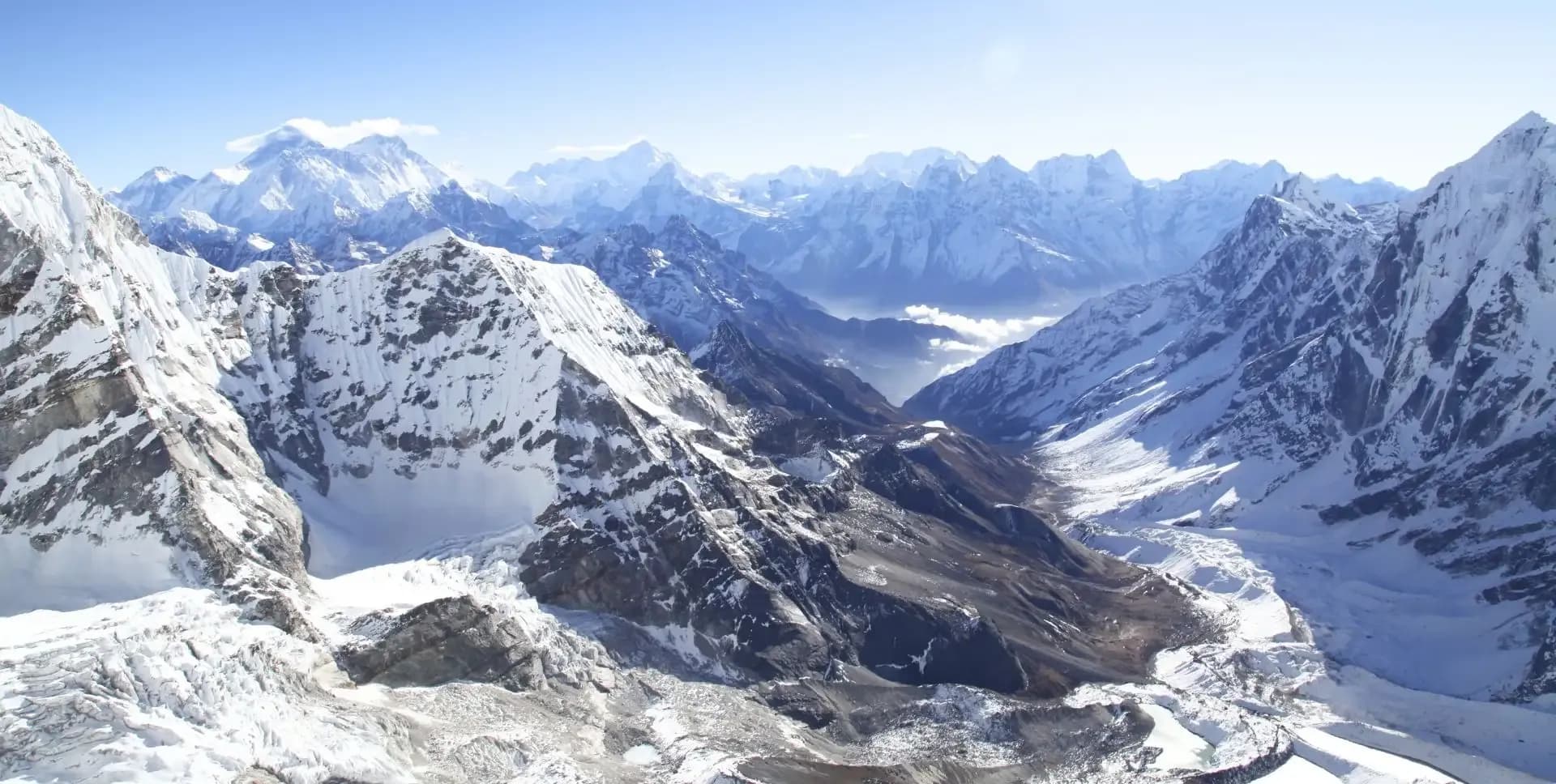
From the summit of Gokyo Ri, the Everest Panorama unfolds in all directions. You can identify Everest (8,849 m), Lhotse (8,516 m), Makalu (8,485 m), and Cho Oyu (8,188 m) from a single vantage point. The Ngozumpa Glacier stretches far below, framed by the surrounding ridges. The Gokyo Lakes also appear in full from this height. You descend back to Gokyo for the remainder of the day. The village offers time for rest, photography, and optional exploration of the fourth and fifth lakes to the north.
The descent route follows the eastern flank of the Dudh Koshi valley on a less-traveled trail. This path separates from the ascent route and passes through the small settlements of Thare and Konar. The trail offers a quieter alternative with consistent views across the valley. The descent is long but follows a manageable gradient.
The route arrives at Phortse Tenga (3,650 m), a small teahouse settlement at the base of the ridge below the village of Phortse. This section of the trail signifies the transition from the Gokyo Lakes valley back to the main Khumbu corridor. The descent from Gokyo to Phortse Tenga takes approximately five to six hours.
From Phortse Tenga, the trail climbs briefly before traversing across to rejoin the main Khumbu trail network. The route descends through forested ridgelines and along the river valley, passing through several small villages. Rhododendron forests provide shade on this section of the trail. The increased fitness gained from the preceding days makes the long return walk considerably easier than the ascent.
Namche Bazar offers a full range of facilities for a comfortable final night in the mountains. You can use this afternoon to restock supplies, charge electronics, or revisit any viewpoints missed during the ascent days. The Everest View from the ridge above Namche Bazar remains available on clear evenings. This stop also provides an opportunity to settle porter payments and tip the guiding team. Trekking time is approximately five to six hours.
The final trekking day retraces the lower trail from Namche Bazar back to Lukla. The trail descends steeply from Namche through the forest to the Dudh Koshi suspension bridge. It then follows the river valley south through the villages of Jorsalle, Monjo, and Phakding before the final climb to Lukla.
The trekking distance from Namche Bazar to Lukla covers approximately nineteen kilometers. The trail is well-marked throughout, and the descent reduces total travel time compared to the ascent. Lukla (2,845 m) provides teahouses and restaurants for a final celebration dinner with the trekking crew. Total trekking time is approximately six hours.
An early morning flight from Lukla returns you to Ramechhap airstrip. The flight takes approximately twenty minutes and retraces the mountain flight scenery from Day 02. Weather conditions can occasionally delay or reschedule mountain flights, so a buffer day in the itinerary is recommended when booking onward travel.
From Ramechhap, a vehicle transfers the group back to Kathmandu. The drive takes approximately four to five hours depending on road conditions and traffic. You arrive in Kathmandu by early to mid-afternoon and transfer to the hotel for check-in.
This free day in Kathmandu provides time for sightseeing, shopping, or rest. The city contains seven UNESCO World Heritage Sites within the Kathmandu Valley. The options include the Boudhanath Stupa, Swayambhunath temple, Pashupatinath temple complex, and the medieval city of Bhaktapur.
The old city of Bhaktapur, the ancient second capital of the Kathmandu Valley, is particularly recommended for its Newari architecture and traditional craft industries. Thamel, the central tourist district, offers bookshops, souvenir markets, trekking gear stores, and a wide selection of restaurants. You should use this day to organize last-minute purchases or travel documentation.
The program concludes on Day 14 with a transfer to Tribhuvan International Airport for onward flights. Departure transfers are arranged in accordance with each traveler's individual flight schedule. Check-out time and vehicle departure times should be confirmed with the tour operator the evening before.
The Gokyo Lakes Trek program officially ends upon hotel check-out. You are advised to confirm airport transfer details and international flight timings in advance to avoid scheduling issues on the final day.
Gokyo Lakes Trek Route Map
Route Map
Altitude Profile
Inclusions
• Private airport transfers in Kathmandu (arrival and departure)
• 3 nights at a 3-star Kathmandu hotel (twin-share, bed and breakfast)
• Round-trip Kathmandu/Ramechhap–Lukla flights with standard baggage allowance
• 10 nights twin-share lodge accommodation during the trek
• Full-board meals throughout the trek (breakfast, lunch, dinner, tea and coffee)
• Drinking water and hot water for bottle refills at all lodge stops
• All required permits (Sagarmatha National Park and Khumbu Pasang Lhamu Rural Municipality)
• Senior English-speaking, government-licensed lead guide with full coverage (wages, meals, accommodation and insurance)
• Assistant guide for every 4 clients, fully covered
• One porter per 2 clients (max 15 kg/client), fully covered
• Emergency medical kit throughout the trek
• Supplemental oxygen, mask and regulator for emergency use
Exclusions
• International Airfare to/from Kathmandu
• Nepal entry visa fee
• Personal travel, medical and emergency evacuation insurance (mandatory; arrange prior to departure)
• Lunch and dinner in Kathmandu
• Additional Kathmandu nights beyond the itinerary (available on request)
• Personal trekking gear and clothing (sleeping bag, boots, trekking poles, down jacket, etc.)
• Alcoholic beverages, specialty hot drinks and bottled/canned drinks during the trek
• Lodge extras charged locally: hot showers, battery charging and Wi-Fi
• Any personal expenses not listed under inclusion
• Guide and porter gratuities (recommended: USD 140/guide, USD 90/porter — at client's discretion)
Date & Price
Want a Private or Tailored Trip?
Book on your own dates, bring a private group, or adjust the itinerary. Our team replies within 24 hours.
Reviews
Write a review
No reviews yet. Be the first to share your experience.
Gallery
No gallery images available.
From (per person)
People also viewed