Kanchenjunga Circuit Trek
From (per person)
Kanchenjunga Circuit Trek Highlights
• Stand at Kanchenjunga North Base Camp (Pangpema) at 5,143 m / 16,873 ft
• Visit Kanchenjunga South Base Camp (Oktang) at 4,730 m / 15,518 ft
• Cross the scenic Sele La Pass connecting the northern and southern valleys
• View Jannu (Kumbhakarna), one of Nepal's most dramatic peaks
• Walk along the moraines of the Kanchenjunga and Yalung glaciers
• Pass through rich rhododendron and conifer forests in the Tamur Valley
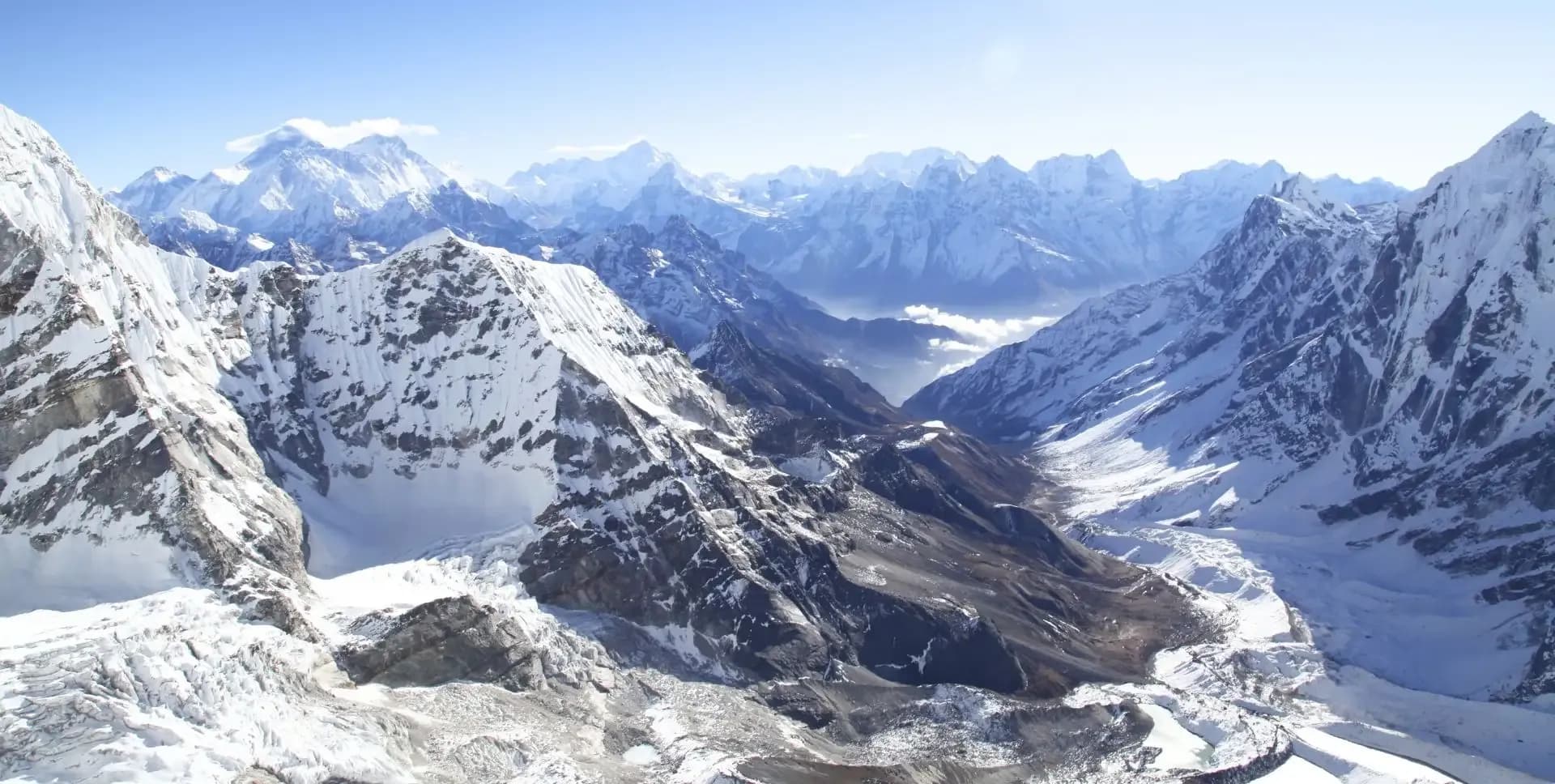
• Observe close-up views of Nepal Peak, Wedge Peak, the Twins, and Tent Peak
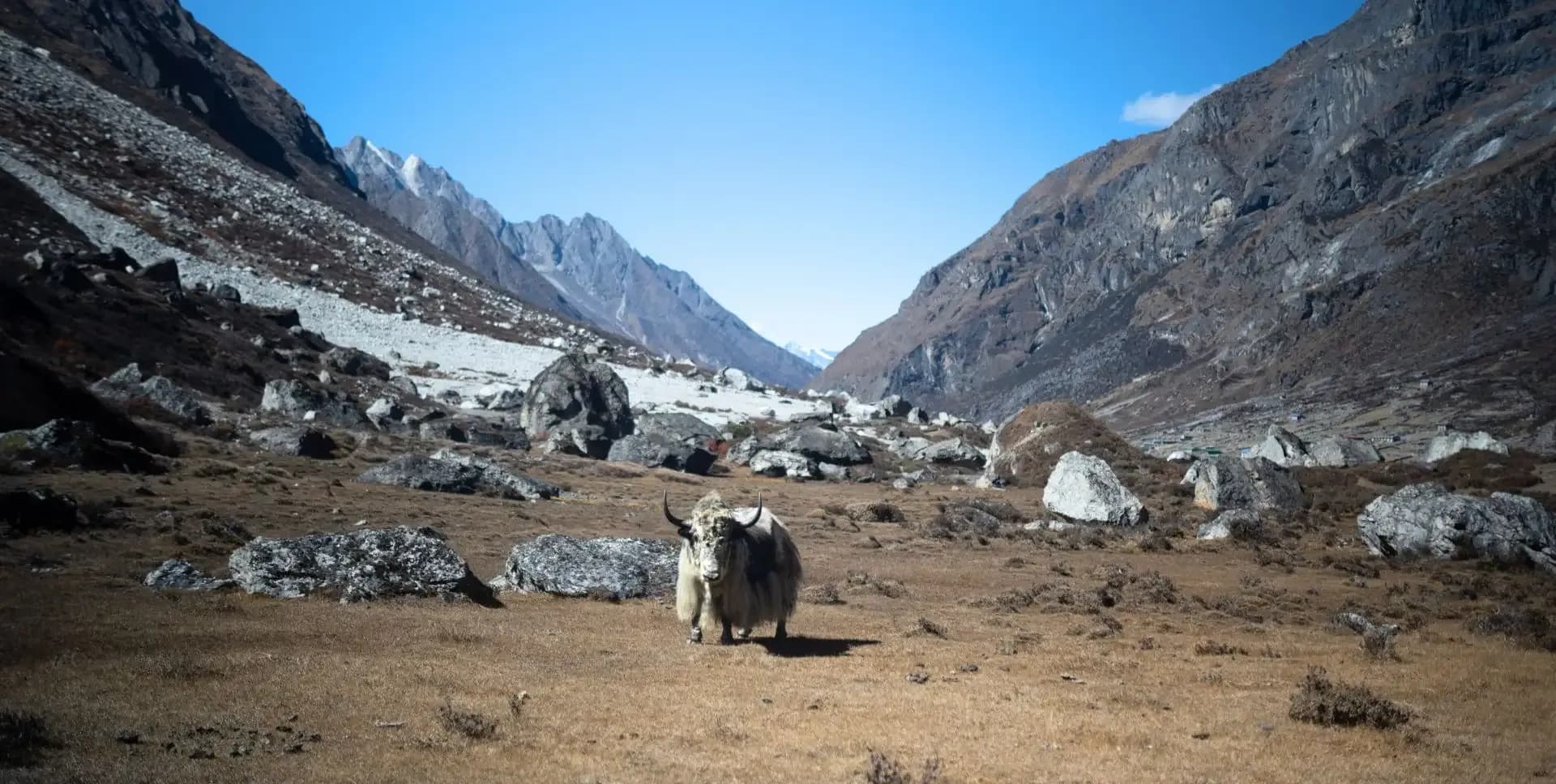
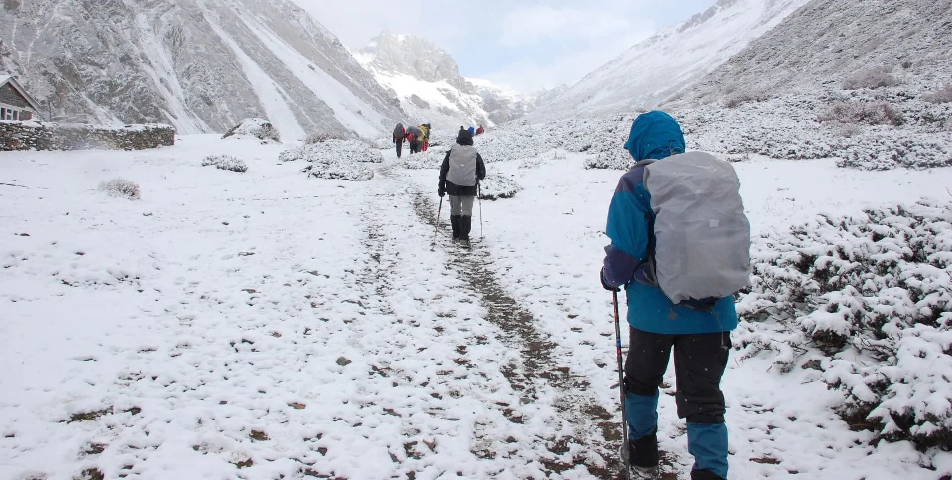
• Trek on one of Nepal's least crowded and most rewarding long-distance routes
Kanchenjunga Circuit Trek Overview
The Kanchenjunga Circuit Trek is a challenging, high-altitude route in the Taplejung District of far-eastern Nepal. The trek takes 20 active days on the trail and reaches a maximum elevation of 5,143 m / 16,873 ft at Pangpema, the Kanchenjunga North Base Camp. The full program spans 24 days, including arrival, departure, and a contingency day.
The route begins with a flight from Kathmandu to Bhadrapur, followed by a road transfer to Ilam and then to Taplejung. From Taplejung, trekkers drive to Sukathum and begin the trail through the Ghunsa Khola Valley. The ascent passes through Amjilosa, Gyabla, and Ghunsa before reaching Khambachen and Lhonak. A day hike from Lhonak leads to Pangpema, the Kanchenjunga North Base Camp.
After returning from the north, the route crosses the Sele La Pass to reach the southern side of Kanchenjunga. A day hike from Cheram leads to Oktang, the Kanchenjunga South Base Camp. The return trail descends through Tortong, Yamphudin, Mamankhe, and Kande Bhanjyang before ending at Suketar. A flight from Bhadrapur returns trekkers to Kathmandu.
The Kanchenjunga Circuit Trek requires a restricted area permit, along with the standard Kanchenjunga Conservation Area permit. The trail passes through the Kanchenjunga Conservation Area, which protects rare Himalayan wildlife, including snow leopards, red pandas, and musk deer. Trekkers should be physically fit and experienced with multi-week, high-altitude treks.
The best seasons for the Kanchenjunga Circuit Trek are spring (March to May) and autumn (October to November). The region is more remote than other trekking areas in Nepal. Teahouses are available at major stops, while camping is the norm at higher elevations. A licensed guide is mandatory for this restricted trekking zone.
Kanchenjunga Circuit Trek Itinerary
Tap any day to read the full programme.
Trekkers arrive at Tribhuvan International Airport in Kathmandu. A representative transfers them to a centrally located hotel in the Thamel district. The trek leader meets the group in the evening for a pre-departure briefing.
During the briefing, the group reviews the itinerary, gear requirements, and permit procedures. Trekkers must submit their original passport, passport-size photos, and travel insurance documents. Insurance must cover high-altitude helicopter evacuation.
Kathmandu sits at an elevation of 1,400 m / 4,593 ft. The city offers easy access to trekking gear shops, banks, and pharmacies. Trekkers needing last-minute equipment can browse the shops in the Thamel district near the hotel.
The second day in Kathmandu focuses on preparation. The trek leader conducts a full gear inspection and ensures all permits are in order. Trekkers confirm their kit meets the requirements for cold-weather and high-altitude conditions.
The guide team reviews route maps and emergency protocols. Trekkers have time to purchase any missing supplies or repack loads for porters. This day also allows trekkers to rest and adjust to Kathmandu's altitude before the journey begins.
An early morning flight departs Kathmandu for Bhadrapur in the eastern Terai. The flight takes approximately one hour and offers clear views of the Himalayan range on a good day. Bhadrapur Airport sits at just 91 m / 299 ft above sea level.
From Bhadrapur, the group boards vehicles for a scenic drive to Ilam, a hill town known for its tea gardens. The drive takes approximately 2.5 hours through the foothills and lowland plains of eastern Nepal. Ilam sits at 1,200 m / 3,937 ft and offers a pleasant overnight stop.
The town is surrounded by rolling tea estates that produce some of Nepal's finest teas. The group checks into a local lodge and rests before the longer drive to Taplejung the following morning.
The group drives from Ilam to Taplejung in the morning. Taplejung is the administrative center of Taplejung District and sits at 1,820 m / 5,971 ft. The road winds through forested ridges and remote villages with views of distant peaks.
After completing permit formalities in Taplejung, the group continues by vehicle to Sukathum at 1,650 m / 5,413 ft. Sukathum is a small settlement at the confluence of the Tamur and Ghunsa rivers. It marks the starting point of the trekking trail and the entrance into the Kanchenjunga Conservation Area.
The crew arranges tents or lodge rooms at Sukathum for the night. Porters sort and distribute loads in preparation for the first day of trekking.
The first trekking day begins at Sukathum and follows the Ghunsa Khola upstream. The trail climbs steadily through dense mixed forest of oak, maple, and rhododendron. The path gains altitude gradually as it moves away from the valley floor.
Trekkers pass through small settlements and cross several side streams. The forested hillsides give shelter from the sun on most of the route. Amjilosa appears on a grassy hillside after several hours of walking.
Amjilosa sits at 2,510 m / 8,235 ft and offers basic lodge accommodation or camping on the grassy terraces. The mountain views improve as the valley opens above the treeline. This day covers moderate terrain and serves as a good warm-up for the steeper sections ahead.
The trail continues up the Ghunsa Khola Valley, climbing through forests of rhododendron and conifer. The path has several steep sections but levels out through open pastures. The valley sides grow more dramatic as trekkers gain elevation.
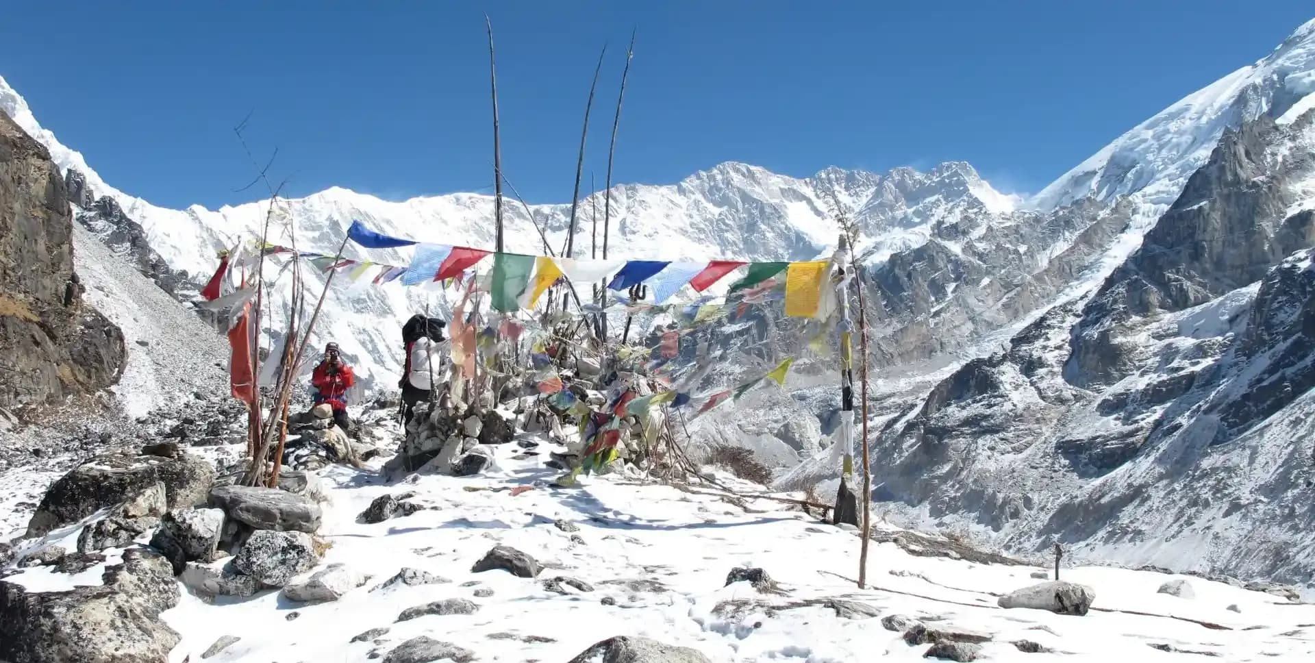
Gyabla is a small Tibetan settlement at 2,730 m / 8,957 ft. Prayer flags mark the village entrance, and stone walls divide the grazing pastures above. The village offers simple lodges and a glimpse of the Tibetan Buddhist culture that becomes more prevalent further up the valley.
The surrounding landscape transitions from subtropical forest to alpine scrub. Views of rocky ridgelines appear above the treeline. Trekkers begin to notice the cooler temperatures at this elevation.
The route continues its steady ascent along the Ghunsa Khola. The forest becomes more open and consists mainly of pine and birch. Several mani walls and chortens line the trail as trekkers approaches the Tibetan cultural zone.
Ghunsa is the largest village on the northern side of the Kanchenjunga Circuit Trek. It sits at 3,595 m / 11,795 ft and is home to a Tibetan refugee community. The village has two gompas, several lodges, and small shops stocking basic supplies.
Prayer flags flutter from the traditional wooden houses in Ghunsa. Trekkers can visit the village monastery and sample local food before the altitude increases further. Ghunsa is also the last major supply point before the high-altitude sections of the trek.
The trail ascends from Ghunsa through beautiful pine and rhododendron forest. The path crosses several small streams and climbs a steep slope before descending to a river crossing. Views of Jannu, also known as Kumbhakarna (7,710 m), dominate the skyline ahead.
After the crossing, the route climbs again past flood plains and rocky moraines to reach Khambachen. The village sits at 4,100 m / 13,451 ft in a wide valley with unobstructed mountain views. The stunning north face of Jannu towers above the settlement.
Khambachen is a summer grazing village and serves as a key acclimatization stop. Lodges offer basic accommodation, and campsites are available on the flat terraces. Mountain views here include Jannu, Kanchenjunga, and several surrounding peaks.
The day begins with a gradual climb from Khambachen through rocky terrain. The trail passes the settlement of Ramtang at around 4,240 m and continues northwest across the Kanchenjunga Glacier moraine. The landscape becomes increasingly barren as the route gains altitude.
Lhonak is a high-altitude camp on a sandy plain near a dry lakebed at 4,785 m / 15,700 ft. Wedge Peak rises directly across the valley, and Nepal Peak, the Twins, Merra, and White Wave all come into view along the ridge. The setting is dramatic and exposed.
Water is scarce at Lhonak, and trekkers must conserve supplies carefully. The camp sits between large boulders, which provide some shelter from the icy wind. Acclimatization at Lhonak is essential before the hike to Pangpema the following day.
This is the highest point of the Kanchenjunga Circuit Trek. The trail from Lhonak ascends steadily across the plain and then climbs the lateral moraine of the Kanchenjunga Glacier. The route to Pangpema takes approximately three to four hours from Lhonak.
Pangpema, also referred to as Kanchenjunga North Base Camp, sits at 5,143 m / 16,873 ft. It is the only point on the circuit where the main north face of Kanchenjunga is fully visible. The peak rises over 3,000 meters above the base camp in a sheer wall of ice and rock.
From Pangpema, experienced trekkers can climb a further 200 to 300 meters up a ridge to the north for even wider views. The panorama includes Kanchenjunga, Wedge Peak, the Twins, and Tent Peak. The group descends back to Lhonak the same afternoon.
The group retraces the route from Lhonak back down to Khambachen. The descent is faster than the ascent, and trekkers can pause to photograph peaks that were passed quickly on the way up. The landscape remains dramatic and barren along the upper valley.
As the trail descends toward Khambachen, the vegetation gradually returns. Mountain views of Jannu remain prominent throughout the descent. The group settles back at Khambachen for a well-earned rest before continuing south.
The descent continues through the Ghunsa Khola Valley from Khambachen to Ghunsa. The trail passes through sections of beautiful alpine forest and along stretches of open riverbank. The route retraces earlier steps but feels easier moving downhill.
Ghunsa offers a welcome break at 3,595 m / 11,795 ft. Trekkers can visit the village gompa, try tungba (traditional Tibetan millet wine), and browse the small local shops. This is also a good opportunity to replace any supplies before the next phase of the Kanchenjunga Circuit Trek.
This section of the Kanchenjunga Circuit Trek crosses from the northern valley system to the southern side of Kanchenjunga. The trail climbs steeply from Ghunsa through rhododendron forest and open hillsides toward the Sele La Pass.
The route ascends steadily with the pass coming into view after several hours of climbing. The Sele La Pass area offers sweeping views of the surrounding ridgelines and peaks. Trekkers pass two or three high mountain lakes on the approach.
The high camp at Sele La sits at 4,290 m / 14,075 ft. This is a challenging day with significant altitude gain. The trail also passes the Mirgin La and other minor passes along the same high ridge. Views from the ridge include Makalu, Everest, Lhotse, Jannu, and down toward the Terai in the south.
The descent from the Sele La High Camp leads into the Simbua Khola Valley on the southern side of Kanchenjunga. The trail drops through rhododendron and conifer forest and crosses several stream beds. The valley grows greener and broader as the route descends.
Cheram, also known as Tseram, is a grazing settlement at 3,870 m / 12,697 ft. It sits on an open plain at the base of the Yalung Glacier moraine. The massive ridgeline of Kabru and Rathong begins to appear above the camp.
Cheram serves as the base for the day hike to Kanchenjunga South Base Camp. The site offers lodge accommodation and camping areas. Night temperatures at this elevation are noticeably cold.
The day hike to Kanchenjunga South Base Camp, also called Oktang, is one of the highlights of the southern section of the Kanchenjunga Circuit Trek. The trail ascends past the snout of the Yalung Glacier into a series of ablation valleys that give relatively easy walking.
The route passes a frozen lake and clear glacier streams. Views of Koktang, Rathong, and Kabru grow closer with each step. At 4,730 m / 15,518 ft, Oktang offers a broad, flat ablation zone directly opposite the south face of Kanchenjunga.
The scenery at Kanchenjunga South Base Camp is among the finest on the entire trek. Trekkers stand beside one of the world's most impressive glaciers with soaring peaks on all sides. The group descends back to Cheram the same afternoon, covering the round trip in approximately seven to eight hours.
The trail descends steeply from Cheram through the Simbua Khola Valley. The route crosses a high wooden bridge before entering dense conifer and alpine forest. The valley sides are steep and dramatic in this section of the descent.
Tortong sits at 2,995 m / 9,826 ft among towering fir trees with several natural rock shelters nearby. The camp is a classic overnight stop in a narrow valley. The descent to Tortong is steep and takes approximately four to five hours from Cheram.
The trail climbs from Tortong over the Deurali Danda, a high forested ridge at around 3,230 m. The ascent is steep and takes approximately three hours through dense jungle. From the top of the pass, Jannu becomes clearly visible to the north.
The descent from the pass crosses a landslip area and then drops steeply through beautiful forest into the valley below. The trail continues along the Kabeli Khola Valley to Yamphudin at 2,080 m / 6,824 ft.
Yamphudin is the most remote settlement in this area and the last large village until the trail rejoins more populated routes. The Kabeli Khola offers clean pools for bathing near the camp. It is an idyllic and peaceful halt after a tough day of climbing and descending.
The trail from Yamphudin descends gradually along the Kabeli Khola. The path contours the hillside above the river, crossing several small ridges and stream beds. The lower altitude brings warmer temperatures and more lush vegetation.
The route passes through small Limbu and Rai settlements with terraced fields and farmland. Cardamom grows freely in the moist, shaded forest at these lower elevations. Mamankhe sits at 1,785 m / 5,856 ft and offers basic lodge accommodation.
The descent to Mamankhe provides a welcome contrast after the high-altitude stages of the Kanchenjunga Circuit Trek. The surrounding forests and farmland feel warm and inviting after the cold nights at Lhonak and Cheram.
The trail climbs from Mamankhe through terraced farmland and forested ridges. The route crosses the Khesewa Khola on a suspension bridge and continues upward through the village of Khesewa. The path is well-defined and passes through several small hamlets.
Kande Bhanjyang is a ridge-top stop at 2,130 m / 6,988 ft. From here, trekkers gain the first clear views of the Kanchenjunga massif from the south and southeast. The panorama includes the south and main summits of Kanchenjunga along with Yalung Kang.
The open ridgeline at Kande Bhanjyang offers excellent photography opportunities. Several teahouses provide refreshments and accommodation on the ridge. This is a significant viewpoint on the final section of the Kanchenjunga Circuit Trek.
The trail follows the ridge from Kande Bhanjyang, passing through rich pastures and small settlements. The route is relatively flat along the ridgeline, with some minor ascents and descents. The open terrain provides wide views of the surrounding hills and valleys.
Lali Kharka sits at 2,265 m / 7,431 ft on a grazing pasture above the valley. The site has wide views and a peaceful atmosphere after many days of challenging terrain. The camp offers a clear perspective of Kanchenjunga from a lower elevation.
This section of the trek passes through the heart of Limbu territory. The communities practice traditional farming and maintain their indigenous Kirant cultural traditions. The trail is well-traveled by local people and porters returning from Taplejung.
The final trekking day leads to Suketar, home of Taplejung Airport, at 2,420 m / 7,940 ft. The trail traverses in and out of narrow valleys and passes through several picturesque villages. The group arrives at Suketar in the late afternoon.
At Suketar, the trek crew says farewell to the porters and local staff. The group boards vehicles for the drive down to Ilam. The road descends from the airport ridge through forested hillsides back to the tea town of Ilam.
Ilam offers a comfortable overnight in a local lodge. The town has several restaurants and shops, and trekkers can relax and reflect on the circuit before returning to Kathmandu.
The group departs Ilam by vehicle for the drive to Chandragadi Airport in Bhadrapur. The drive takes approximately 2.5 hours through the forested Terai foothills. The flight from Bhadrapur to Kathmandu takes about one hour.
On arrival in Kathmandu, the group transfers to the hotel in the Thamel district. The evening is free for a celebratory dinner at one of Kathmandu's many restaurants.
Day 23 is reserved as a buffer day to account for weather delays, flight cancellations, or adjustments in the trekking schedule. Remote Himalayan routes like the Kanchenjunga Circuit Trek are subject to unpredictable weather, especially during the monsoon fringe seasons.
If the group completes the trek on schedule, this day becomes a free day in Kathmandu. Trekkers can visit the UNESCO World Heritage Sites of Pashupatinath Temple, Boudhanath Stupa, or Swayambhunath. Souvenir shopping, spa visits, and sightseeing tours are available through the hotel.
The trek leader uses this day at their discretion based on the group's progress and any accumulated delays. No additional cost applies if the contingency day is not required.
The final day of the Kanchenjunga Circuit Trek program ends after breakfast. Airport transfers to Tribhuvan International Airport are provided for all departure flights. Trekkers should arrange international flights to depart from Kathmandu on this day.
Kanchenjunga Circuit Trek Route Map
Route Map
Altitude Profile
Inclusions
• Private airport transfers in Kathmandu (arrival & departure)
• 4 nights at a 3-star Kathmandu hotel (twin-share, bed & breakfast)
• Round-trip flights between Kathmandu and Bhadrapur with standard baggage allowance
• Private jeep transfer from Bhadrapur to Illam, Taplejung, and Sukathum; return from Suketar to Illam and Bhadrapur Airport
• 17 nights twin-share lodge accommodation during the trek
• Full-board meals throughout the trek (breakfast, lunch, dinner, tea & coffee)
• Drinking water and hot water for bottle refills at all lodge stops
• All required permits (Kanchenjunga Restricted Area Permit, Kanchenjunga Conservation Area Permit & TIMS Card)
• Senior English-speaking, government-licensed lead guide, fully covered (wages, meals, accommodation & insurance)
• Assistant guide for every 4 clients, fully covered
• One porter per 2 clients (max 15 kg/client), fully covered
• Emergency medical kit throughout the trek
• Supplemental oxygen, mask & regulator for emergency use
Exclusions
• International Airfare to/from Kathmandu
• Nepal entry visa fee
• Personal travel, medical & emergency evacuation insurance (mandatory; arrange prior to departure)
• Lunch & dinner in Kathmandu
• Additional Kathmandu nights beyond the itinerary (available on request)
• Single room supplement or forced single room charges, where applicable
• Personal trekking gear & clothing (sleeping bag, boots, trekking poles, down jacket, etc.)
• Alcoholic beverages, specialty hot drinks & bottled/canned drinks during the trek
• Lodge extras charged locally: hot showers, battery charging & Wi-Fi
• Any personal expenses not listed under inclusion
• Guide & porter gratuities (recommended: USD 200/guide, USD 150/porter, at client's discretion)
Date & Price
Want a Private or Tailored Trip?
Book on your own dates, bring a private group, or adjust the itinerary. Our team replies within 24 hours.
Reviews
Write a review
No reviews yet. Be the first to share your experience.
Gallery
No gallery images available.
From (per person)
People also viewed