Tsum Valley Trek
From (per person)
Tsum Valley Trek Highlights
• Tsum Valley: Nepal's most secluded and sacred Himalayan valley
• Off the Beaten Trek: A remote route far from the crowded trekking trails of Nepal
• Mu Gompa: The highest monastery in Tsum Valley at 3,700 m / 12,139 ft
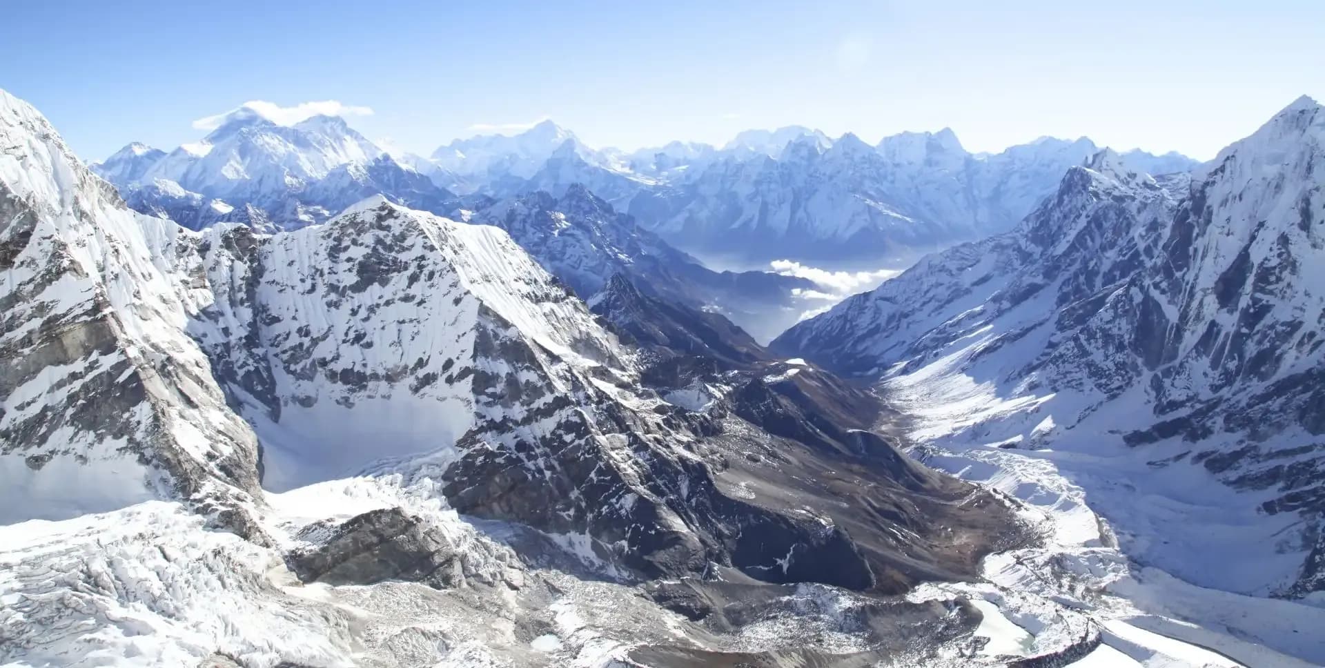
• Manaslu Range Views: Panoramic views of Manaslu (8,163 m), Ganesh Himal, and Sringi Himal (7,187 m)
• Rachen Gompa: One of the most important nunneries in the Tsum Valley region
• Chhokang Paro: A high-altitude village at 3,031 m set amid wide open steppe landscapes
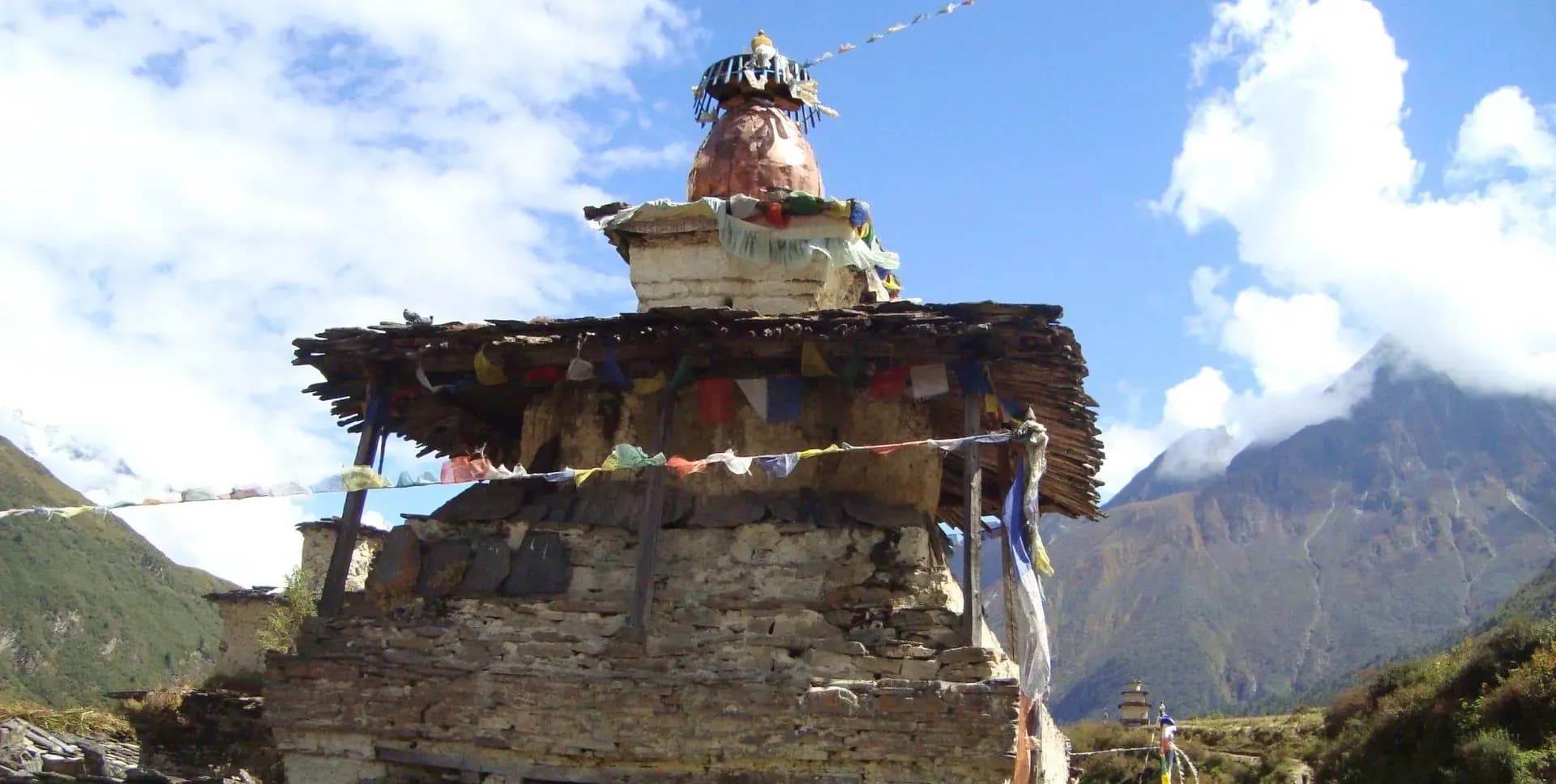
• Buddhist Culture: Encounter ancient Tibetan-influenced traditions, monasteries, and mani walls
• Local Village Life: Experience life in remote farming communities largely unchanged by modernization
Tsum Valley Trek Overview
The Tsum Valley trek takes trekkers into one of Nepal's most remote and culturally intact mountain valleys. Tsum Valley sits in the northern reaches of the Manaslu Conservation Area, directly bordering the Tibetan Autonomous Region of China. This off the beaten trek draws visitors who seek a genuine Himalayan experience far from the popular and crowded routes of Nepal. The Nepali government kept the valley closed to foreign trekkers until 2008, which helped preserve its culture and natural environment.
The word 'Tsum' derives from the Tibetan word 'Tsombo,' meaning vivid or clear. The valley stretches approximately 40 kilometers from its lower entrance near Chumling to the upper reaches at Mu Gompa. The Tsumba people who live in the valley are of Tibetan origin and practice the Nyngmapa sect of Tibetan Buddhism. Monasteries, mani walls, chortens, and prayer flags are found throughout every village and along every trail.
The trek begins with a long drive from Kathmandu toward the Budhi Gandaki river valley. Trekkers join the famous Manaslu Circuit route for the first few days before branching north into Tsum Valley near Lokpa. The trail passes through dense rhododendron forests, dramatic river gorges, and terraced farmland before opening into the wide plateau landscape of the upper valley. Villages along the route follow Tibetan Buddhist traditions and maintain customs that have remained largely unchanged for generations.
The highest point of this off the beaten trek is Mu Gompa at 3,700 m / 12,139 ft. Mu Gompa is the last permanent settlement in Tsum Valley and functions as an active working monastery. The trail to Mu Gompa offers close views of the peaks surrounding the upper valley and gives trekkers a rare look at monastic life in the high Himalayas. Trekkers stay in local teahouses and guesthouses throughout the journey, directly supporting remote communities.
The itinerary spans 12 days and follows a round-trip route through Tsum Valley. The trek is moderately challenging, with one demanding ascent on Day 4 when the trail gains over 1,600 m of elevation from Philim to Chumling. Trekkers require a Tsum Valley Restricted Area Permit in addition to the Manaslu Conservation Area Permit (MCAP). Both permits must be arranged in Kathmandu before departure. The best time to trek to Tsum Valley is from March to May and from September to November, when the weather is stable, and the views are clear.
Tsum Valley Trek Itinerary
Tap any day to read the full programme.
Arrive at Tribhuvan International Airport in Kathmandu. A guide or an office representative meet will meet at the airport and transfer to the hotel. The rest of the day is free for rest and exploration. In the evening meet for the trek briefing.
The drive from Kathmandu to Machha Khola takes approximately 8 to 9 hours. The road follows the Trisuli River before turning toward Arughat and continuing along the Budhi Gandaki valley. The route passes through Dadhingbesi, the district headquarters of Dhading, and several small roadside villages. Road conditions vary and can be rough in places, particularly after the monsoon season.
The drive offers a gradual transition from the urban pace of Kathmandu to the rural Himalayan landscape. Villages along the road give trekkers an early look at traditional farming life in the mid-hill region. Terraced rice and corn fields cover the hillsides for much of the journey. Mule trains are often seen along the lower sections of the valley, carrying supplies to remote villages higher up.
Machha Khola sits at 869 m and is a small settlement along the Budhi Gandaki River. The name Machha Khola means 'fish stream' in Nepali. Basic accommodation is available at local guesthouses.
The day begins with a short drive from Machha Khola to Jagat at 1,340 m. The drive takes about 1 to 2 hours depending on road conditions. Jagat is a checkpoint village where trekkers must register their permits before entering the Manaslu Conservation Area. Authorities check permits here for the Manaslu Circuit and Tsum Valley routes.
From Jagat, trek begins walking on the well-established Manaslu Circuit trail heading north. The trail follows the Budhi Gandaki River through narrow gorges, suspension bridges, and small farming settlements. Stone-paved paths and narrow cliff-hugging trails characterize this section. Mule caravans frequently use the same route to carry essential goods to villages further up the valley.
The walk from Jagat to Philim takes approximately 3 to 4 hours. The terrain is hilly and follows the riverbank through mixed vegetation, including stands of pine and bamboo. Philim sits at 1,570 m and is a larger, ethnically diverse village with both Gurung and Tibetan-origin residents. Several guesthouses and tea shops are available. Trekkers settle in for the night after lunch in Philim.
Today marks the entry into Tsum Valley. Just before the village of Lokpa, the trail branches north and leaves the Manaslu Circuit route. The path climbs steeply through rhododendron forests with views of Sringi Himal (7,187 m) visible to the north. A lunch stop at Lokpa breaks the long ascent.
After Lokpa, the trail descends to the river before climbing again toward Chumling. A suspension bridge crosses the Siyar Khola just before Chumling. At this point, the landscape opens into a wide green valley with scattered stone farmhouses. This is the beginning of Tsum Valley.
Chumling sits at 2,386 m and is surrounded by the Manaslu, Ganesh Himal, and Tibetan mountain ranges. The day involves a total ascent of approximately 1,600 m from Philim, making it the most demanding day of the trek. Trekkers check in to a guesthouse in Chumling for the night.
The trek from Chumling to Chhokang Paro takes approximately 3 to 4 hours. The trail crosses the valley floor and climbs steadily to the upper village. The ascent is moderate and well-graded compared to the previous day. Small mani walls and prayer flags mark the trail as it enters more deeply Buddhist territory.
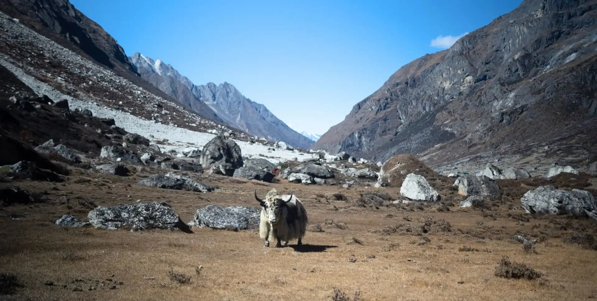
Chhokang Paro sits at 3,031 m and marks a significant change in landscape and atmosphere. The terrain shifts from forested hillsides to an open steppe plateau that stretches toward the Tibetan border. Farmers in Chhokang Paro still plow their high-altitude fields using traditional yokes and draft animals. Horses and yaks roam freely through the village lanes, a sight uncommon lower in the valley.
The village is largely self-sufficient and shows few signs of outside influence. Stone houses with flat roofs and small window frames line the narrow pathways. The afternoon is free to explore the village and observe daily life. Views of the surrounding mountain ranges are clear from this elevation. Trekkers stay overnight at a local guesthouse in Chhokang Paro.
The trail from Chhokang Paro continues through the open steppe landscape of the upper Tsum Valley. The walk takes approximately 5 to 6 hours to reach Nile at 3,361 m. The path follows relatively flat terrain through wide grazing meadows before a final climb into the village. Along the way, trekkers cross several small streams fed by glacial melt from the surrounding peaks.
Two important monasteries lie along the route between Chhokang Paro and Nile. Rachen Gompa is one of the most significant nunneries in the region and houses dozens of nuns practicing Tibetan Buddhism. Gonghyul Gompa sits nearby and is also an active place of worship. Trekkers typically stop at Rachen Gompa for lunch and a short visit before continuing toward Nile.
Nile is the last major village before the upper valley and sits at 3,361 m. The steppe landscape ends here, and high Himalayan terrain begins. Stone walls border the trail into the village, and prayer flags are strung across rooftops and hilltops. The mountain scenery becomes more dramatic as the valley narrows toward the north. Trekkers spend the night at a local guesthouse in Nile and prepare for the highlight day of the trek.
This is the highlight day of the Tsum Valley trek. Trekkers set out early from Nile and hike to Mu Gompa, the highest point of the trek at 3,700 m. The hike takes approximately 3 to 4 hours each way. The trail climbs through a rocky high-altitude landscape with wide views of the surrounding peaks.
Mu Gompa is both a monastery and the final permanent settlement in Tsum Valley. It is home to monks who follow the Tibetan Buddhist tradition. The monastery itself is an active place of worship and meditation. Trekkers can tour the grounds and observe daily monastic life.
The views from Mu Gompa include several peaks above 5,000 m and extend toward the Tibetan plateau. After spending time at the monastery, trekkers descend back to Nile by the afternoon. This day is the highest point of the off the beaten trek through Tsum Valley. Dinner and overnight stay are in Nile.
The day begins the return journey through Tsum Valley. Trekkers retrace the trail from Nile through Chhokang Paro and descend to Chumling at 2,386 m. The descent offers a fresh perspective on the valley with reverse views of the mountains and settlements encountered on the way up.
The walk takes approximately 5 to 6 hours. The wide steppe between Nile and Chhokang Paro is particularly scenic on clear mornings, with sharp light on the surrounding peaks. The descent from Chhokang Paro toward Chumling follows a well-marked trail through forested terrain. The change in vegetation becomes apparent quickly as the elevation drops.
The trail through the lower section passes through stands of rhododendron and pine before reaching the suspension bridge above Chumling. Looking back from the bridge, the valley stretches north toward the Tibetan border. Trekkers stay overnight at a guesthouse in Chumling, the same settlement visited on Day 4.
The trail from Chumling descends back toward the Budhi Gandaki valley. Trekkers pass through the junction where the Tsum Valley trail meets the Manaslu Circuit route near Lokpa. A lunch stop at Lokpa is typical before the descent continues to Philim at 1,570 m.
The walk takes approximately 5 to 6 hours. The descent covers significant elevation loss and passes through rhododendron and mixed forest. The return through this section highlights the contrast between the open steppe of upper Tsum Valley and the lush lower valley with its thick vegetation and narrow gorges.
Trekkers re-enter the lower valley environment and notice the warmer temperatures and denser tree cover. The sounds of the Budhi Gandaki River become more prominent as the trail approaches Philim. Trekkers check back in to a guesthouse in Philim for the night and enjoy dinner after a long day's walk.
The final trekking day takes trekkers from Philim back to Jagat at 1,340 m along the Manaslu Circuit trail. The walk takes approximately 3 to 4 hours. From Jagat, a vehicle waits to drive the group to Machha Khola at 869 m. The drive takes about 1 to 2 hours along the Budhi Gandaki valley road.
Machha Khola serves as the overnight stop before the final long drive back to Kathmandu. Trekkers check in to a local guesthouse and celebrate the completion of the Tsum Valley trek. A farewell dinner is typically arranged in the evening.
The return drive from Machha Khola to Kathmandu takes approximately 8 to 9 hours. The road retraces the outbound route, following the Budhi Gandaki and then the Trisuli river valleys. The drive passes through Arughat, Dadhingbesi, and the Trisuli valley before reaching the Kathmandu ring road. Road conditions in this section can vary seasonally. You will arrive in Kathmandu in the late afternoon or early evening, depending on departure time and road conditions. Transfer to the hotel is arranged upon arrival.
Today marks the end of the Tsum Valley trek program. Trekkers are transferred to Tribhuvan International Airport at the appropriate time based on flight schedules. The transfer is included in the program.
Tsum Valley Trek Route Map
Route Map
Altitude Profile
Inclusions
• Private airport transfers in Kathmandu (arrival & departure)
• Private jeep transfer from Kathmandu to Machha Khola, onward to Jagat, and return from Jagat to Kathmandu via Machha Khola
• 2 nights at a 3-star Kathmandu hotel (twin-share, bed & breakfast)
• 9 nights twin-share lodge accommodation during the trek
• Full-board meals throughout the trek (breakfast, lunch, dinner, tea & coffee)
• Drinking water and hot water for bottle refills at all lodge stops
• All required permits (Tsum Valley Restricted Area Permit, Manaslu Conservation Area Permit & Chumnubri Rural Municipality Permit)
• Senior English-speaking, government-licensed lead guide, fully covered (wages, meals, accommodation & insurance)
• Assistant guide for every 4 clients, fully covered
• One porter per 2 clients (max 15 kg/client), fully covered
• Emergency medical kit throughout the trek
• Supplemental oxygen, mask & regulator for emergency use
Exclusions
• International Airfare to/from Kathmandu
• Nepal entry visa fee
• Personal travel, medical & emergency evacuation insurance (mandatory; arrange prior to departure)
• Lunch & dinner in Kathmandu
• Additional Kathmandu nights beyond the itinerary (available on request)
• Single room supplement or forced single room charges, where applicable
• Personal trekking gear & clothing (sleeping bag, boots, trekking poles, down jacket, etc.)
• Alcoholic beverages, specialty hot drinks & bottled/canned drinks during the trek
• Lodge extras charged locally: hot showers, battery charging & Wi-Fi
• Any personal expenses not listed under inclusion
• Guide & porter gratuities (recommended: USD 100/guide, USD 65/porter — at client's discretion)
Date & Price
Want a Private or Tailored Trip?
Book on your own dates, bring a private group, or adjust the itinerary. Our team replies within 24 hours.
Reviews
Write a review
No reviews yet. Be the first to share your experience.
Gallery
No gallery images available.
From (per person)
People also viewed