Mera Peak Climbing
From (per person)
Mera Peak Climbing Highlights
• Stand on the central summit of Mera Peak at 6,461 meters, the highest of Nepal's officially designated trekking peaks
• Take in a summit panorama that includes five of the six highest mountains on earth: Everest, Kangchenjunga, Lhotse, Makalu and Cho Oyu, with Ama Dablam, Baruntse, Kangtega and Nuptse filling the skyline between them.
• Approach through the quiet Hinku valley by way of Paiya, Panggom and Ningsow, a longer and gentler route than the direct crossing of the Zatrwa La, which gives your body time to adapt to altitude.
• Walk through Sherpa and Rai farming villages in the lower Solukhumbu, then through untouched forest of rhododendron, pine and bamboo where red pandas still live.
• Learn crampon, ice axe, harness and fixed-rope techniques at the pre-climb briefing in Kathmandu and again on the moraine and glacier below Khare before you need them for real.
• Build acclimatization into the program with rest days at Thangnak and Khare and a dedicated contingency day for the summit.
• Cross the Zatrwa La at 4,600 meters on the return to Lukla, a fitting final climb with views back across the Hinku to the mountain you have just climbed.
• Climb with an experienced Sherpa climbing guide and a support crew who have spent years on this route and know its snow, weather and moods.
Mera Peak Climbing Overview
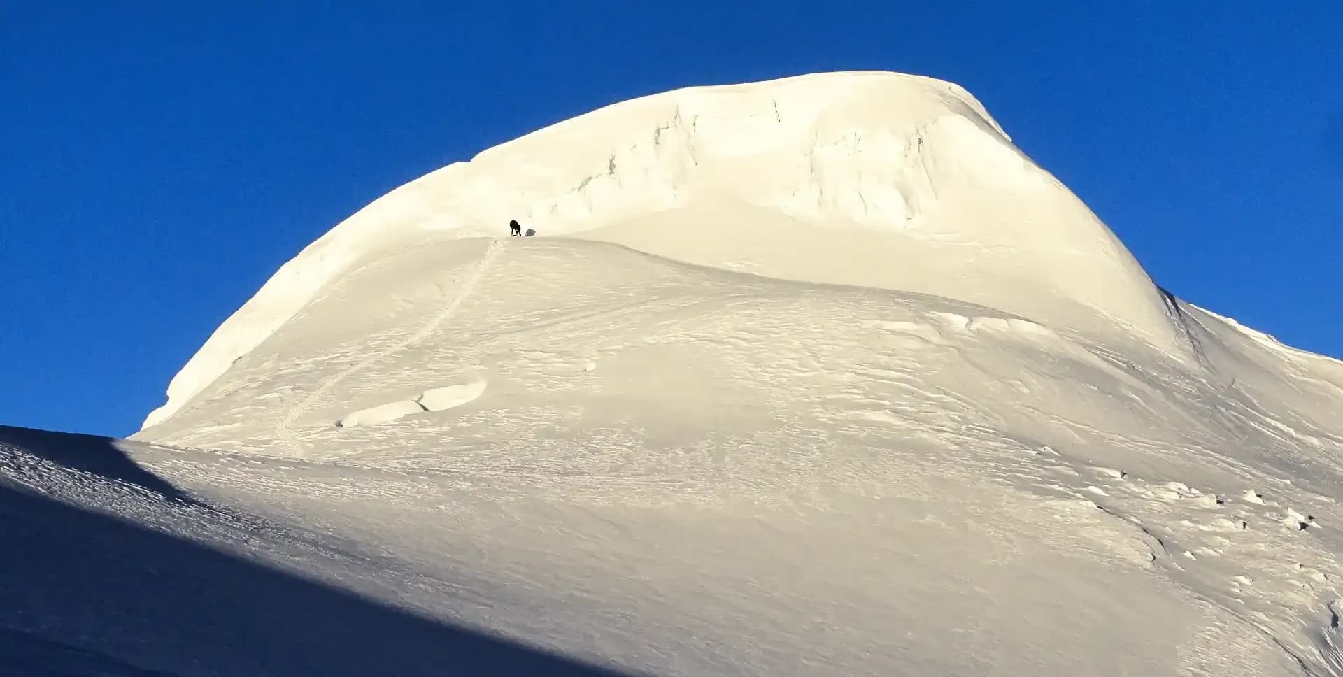
Mera Peak stands at the head of the Hinku valley, south of Everest and well away from the busy Khumbu trails. Its northern top reaches 6,476 meters, making Mera the highest of the trekking peaks listed by the Nepal Mountaineering Association. On this program we climb the central summit at 6,461 meters, the top reached by the standard route from the Mera La and the one with the widest view. It is higher than any mountain in Europe or North America, and for many climbers it is a first summit above 6,000 meters.
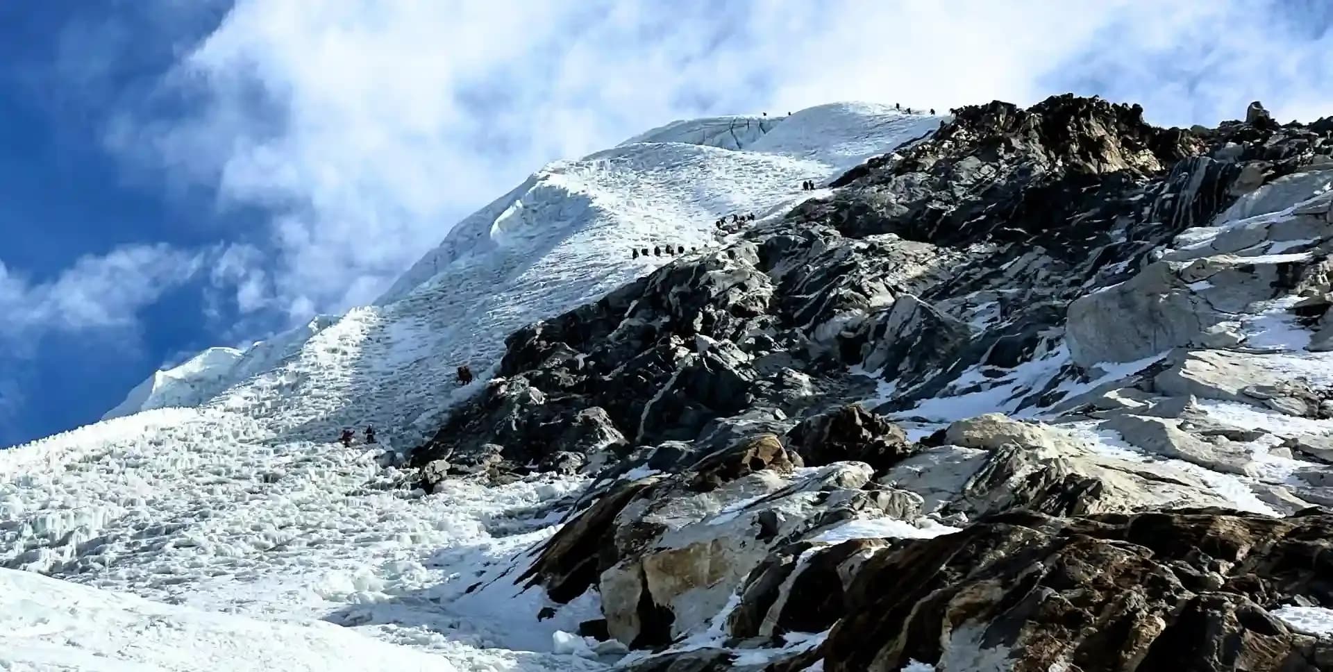
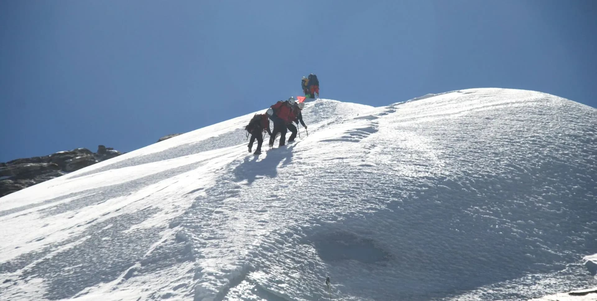
The climbing is graded Alpine F, the easiest alpine grade. Most of the ascent is glacier walking on crampons, roped to your teammates for protection against crevasses. The exception is the final dome below the central summit, where the slope steepens to roughly 45 degrees for the last 30 to 40 meters and the guides fix a rope for you to climb with a jumar, a handled clamp that slides up the rope and locks when weighted. No previous climbing experience is required, but you need to be fit and willing to learn the basics of moving on snow and ice, which we teach in Kathmandu and practice again below Khare.
Altitude is the real challenge. Summit day starts around 2 am from High Camp at 5,780 meters, climbs close to 700 meters to the top and then descends all the way to Khare, ten to twelve hours in cold, thin air. The itinerary is therefore built around acclimatization. Instead of crossing the Zatrwa La directly from Lukla, we walk through Paiya, Panggom and Ningsow and enter the Hinku valley low down, gaining height gradually over a week. Rest days at Thangnak and Khare, a night at High Camp and a contingency day for weather complete the plan.
The approach is as rewarding as the climb. The first days pass through Sherpa and Rai villages, terraced fields and rhododendron forest. Beyond Ningsow the trail follows the deep, forested gorge of the Hinku Khola, where landslide sections demand care and red pandas are occasionally seen. Above Kothe the valley opens into yak pasture and moraine beneath Kusum Kanguru and Peak 43.
Accommodation is in simple mountain lodges as far as Khare, with one night in tents at High Camp. From the summit on a clear morning you look across to Everest, Lhotse, Makalu, Cho Oyu and Kangchenjunga, five of the six highest mountains in the world, with Ama Dablam, Baruntse and Kangtega in the foreground. Few places in the Himalaya offer a view of this scale to climbers without technical experience, and that is what makes Mera worth the effort.
Mera Peak Climbing Itinerary
Tap any day to read the full programme.
Your guide meets you at the arrival gate of Tribhuvan International Airport and drives you to the hotel, a short walk from the shops and restaurants of Thamel. Once you have checked in, the rest of the day is yours. Depending on when you and the other members of the group arrive, the guide sets a time for a short welcome meeting, usually in the late afternoon or early evening. This is a chance to meet the team, go through the plan for the coming days and ask any questions about the trek and the climb. Kathmandu is noisy, colorful and a little chaotic after a long flight, so an early night is a good idea.
Today is set aside for preparation. Your climbing guide comes to the hotel and goes through your equipment item by item, from base layers and down jacket to boots, crampons, harness, ice axe and helmet. Anything missing or unsuitable can be hired or bought in Thamel, where a number of shops specialize in mountaineering gear, and the guide is happy to come with you. In the afternoon the guide demonstrates how to fit crampons to your boots, put on the harness, tie the knots we use on the mountain and attach a jumar to a fixed rope. The permits for the trek and climb are finalized during the day. You pack your trek bag and leave anything you do not need at the hotel.
We leave Kathmandu before dawn for the drive to the airstrip at Ramechhap, roughly four to five hours to the east. From there a twenty-minute flight carries us over ridges of terraced hillside to the sloping runway at Lukla, where our porters and support crew are waiting. After tea, we shoulder our packs and set off. The trail drops steeply below Lukla to the Sherpa settlement of Surke, then climbs the far side of the valley through pine and rhododendron forest. In spring the rhododendrons are in flower, and the hillsides glow red and pink. A final level stretch through the trees brings us to Paiya, a small village of lodges above the Dudh Koshi.
The day begins with a steady climb of about an hour and a half through dense forest to the Kari La at 2,900 meters. From the pass we look ahead to Panggom, already visible on the hillside across the valley, and catch glimpses of snow peaks appearing above the cloud. The trail then descends gradually for an hour to our lunch stop. In the afternoon we climb again, a series of switchbacks gaining height gently through forest and past scattered farms, to reach Panggom in about two and a half hours. Panggom is a Sherpa farming village with a monastery, terraced fields and a handful of lodges. It sits on the ridge that separates the Dudh Koshi from the Hinku, and tomorrow we cross it.
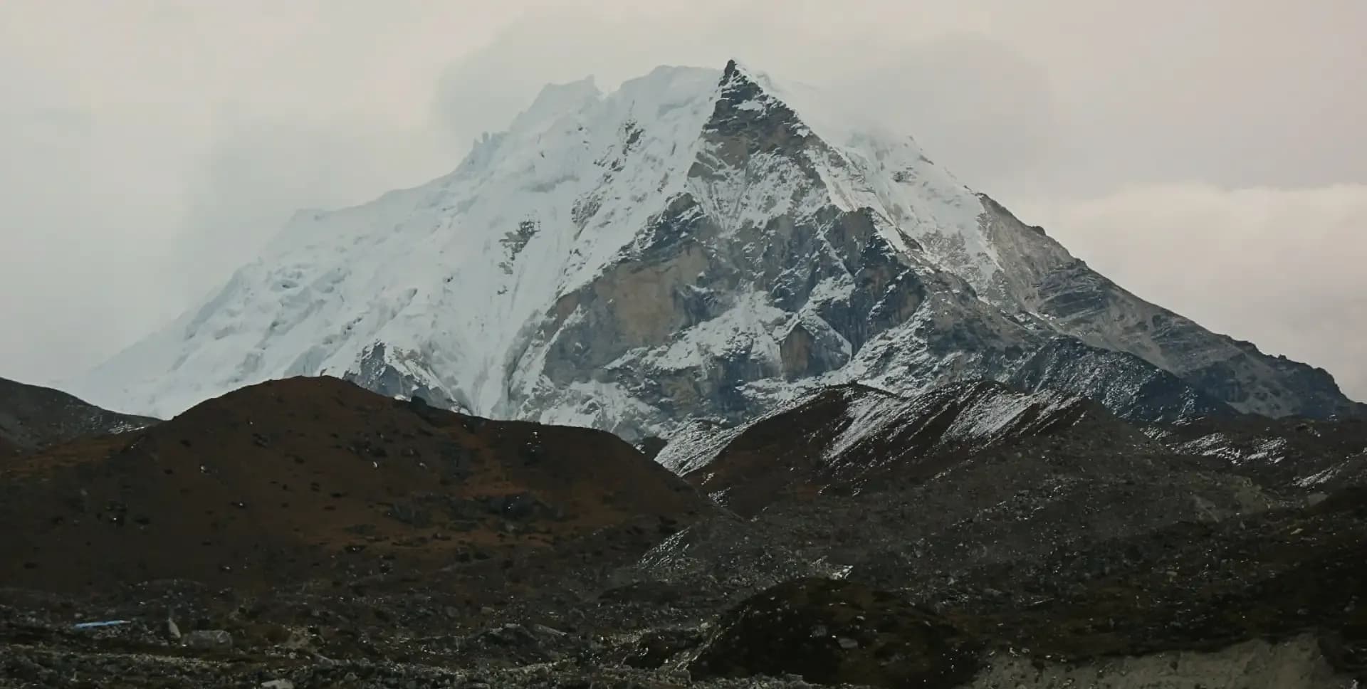
A short, sharp climb above the village brings us to Panggom La at 3,174 meters, the watershed between the Dudh Koshi and the Hinku Khola. From the pass we see Mera Peak for the first time, a broad white shape at the head of the valley to the north-east. We cross into the Hinku side and descend around 300 meters to the village of Sibuje, one of the last permanent settlements on our route. Beyond Sibuje the trail crosses the Ningsow river on a bridge and rises through forest to Ningsow itself, little more than a clearing with a couple of lodges and herders' huts. The walk is short today, about four hours, which leaves the afternoon free to rest.
Apart from summit day, this is the most demanding day of the trek and one that calls for care. The trail climbs steeply out of Ningsow to a lodge at around 3,280 meters, then on to the high point of the day at about 3,350 meters before dropping back to the river for lunch. The afternoon is a switchback of ascents and descents along the steep, forested western wall of the Hinku Khola, with the river thundering far below and several landslide sections to cross. This is one of the few remaining habitats of the red panda, and sightings do happen. Late in the day we cross the river on a bridge made from a single huge tree trunk and reach Jungle Camp, a lodge deep in the forest at Chhetra Khola.
After breakfast we climb about 500 meters through untouched forest of tall pine, moss and lichen, with rhododendron and bamboo crowding the trail. Where the trees open, the views are striking south to the rolling hills we crossed a few days ago and north to Mera Peak, its steep south-west face clearly visible for the first time. The trail then rolls along the valley side, dipping in and out of side streams, before descending to the upper Hinku Khola. Kothe sits on a sandy, boulder-strewn flat beside the river at 3,580 meters. It has several seasonal lodges and small shops and is used as a summer yak pasture. Tonight we sleep above the tree line for the first time.
The landscape changes character today. We follow the west bank of the Hinku Khola northwards and the forest thins and disappears, leaving an open, treeless valley of grazing land and moraine. The twin summits of Kusum Kanguru rise on our left, the dark west face of Mera fills the right-hand skyline, and ahead, framed by the valley, stands Peak 43, also known as Kyashar. We stop for lunch at Gondishung, a summer herders' settlement with stone-walled enclosures and a long mani wall of carved prayer stones. A little further on, a small gompa built beneath a huge boulder is a traditional place to burn junipers and ask for a safe climb. An hour across the moraine brings us to the lodges of Thangnak.
This is the first of two planned acclimatization days and we use it actively. After breakfast we hike for around four hours towards the glacier and the ridge that runs down from Kusum Kanguru, climbing to about 5,000 meters before turning back. The rule of climbing high and sleeping low helps the body adjust, and the viewpoint gives a clear line of sight to Kusum Kanguru's ice faces and, across the valley, to the moraines leading up towards the Mera La. Back at the lodge, the afternoon is for rest, hot drinks, laundry and a wash if the sun is out. Your guide checks how everyone is feeling and adjusts the pace of the coming days if needed.
We head east out of Thangnak on a good trail that climbs onto the moraine of the Dig Glacier. The gradient is gentle, but you feel the altitude in every step. In about half an hour we reach a crest lined with cairns above a turquoise glacial lake held back by the moraine, then drop into a sandy bowl and follow a stream up to the wide pasture of Dig Kharka. From here the lodges of Khare are in sight. We cross the stream on steppingstones and climb steadily for another hour and a half to reach Khare, the base for Mera Peak, at just over 5,000 meters. Having walked a northerly arc around the mountain, we now look straight at Mera's north face.
Our second acclimatization day combines a short hike with climbing practice. In the morning we walk up to the moraine ridge above the lodges, gaining around 150 meters, for a clear view of the Mera La and the route we take onto the glacier tomorrow. After lunch we move to the moraine and scree at the foot of the Mera Glacier and spend two to three hours with the guides fitting crampons, walking on snow and ice, using the ice axe, roping up and climbing a fixed line with a jumar. Everyone practices until the movements feel natural. Back at the lodge, we pack our mountain bags, leaving anything not needed for the climb at Khare, and go to bed early.
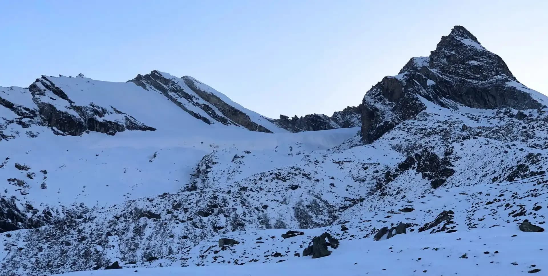
Today the climb begins. Above Khare we cross the moraine crest and climb a steep slope of scree or snow into a boulder-strewn bowl beneath the tongue of the Mera Glacier. On a rock platform beside the ice we fit crampons and climb a short, steeper section onto the plateau. A track weaves between crevasses for about an hour to the prayer flags on the Mera La at 5,415 meters, where the view opens north to Makalu, Everest and Lhotse. From the pass, broad snow slopes rise south-west for another three to four hours to High Camp, tucked behind a rocky outcrop at 5,780 meters. The crew pitches the tents while you drink as much tea and soup as you can.
A 2 am wake-up call, bed tea and a light breakfast. We fit crampons, rope up and start climbing by headtorch across easy-angled snow, the Himalaya a line of black shapes against the stars. Dawn breaks after about an hour and colors Makalu and Everest in turn. The route crosses a series of false summits and skirts crevasses before reaching the foot of the summit dome, where the slope steeps to around 45 degrees for the last 30 to 40 meters. Here the guides fix a rope, and we climb the final pitch with a jumar to the central summit of Mera at 6,461 meters. Five of the six highest mountains on earth stand around you. After time for photographs we descend to High Camp for hot drinks, then continue down past the Mera La to Khare. Expect ten to twelve hours in total.
This day is built into the program as a weather buffer. High winds, fresh snowfall or poor visibility can make a summit attempt unsafe on the planned day, and having a spare day means the group can wait at High Camp and try again rather than abandon the climb. Your guide makes this decision based on conditions and the state of the team. If the summit goes to plan on Day 13, the day becomes a well-earned rest day at Khare, with time to sleep, eat and let tired legs recover before the walk out. At the guide's discretion the group may instead move down the valley a day early, which adds a spare day at the end of the trip in case the Lukla flight is delayed.
We leave Khare and retrace the trail down the Hinku valley. The descent of almost 1,500 meters feels remarkably easy after the days spent above 5,000 meters. With more oxygen in every breath and blood that has adapted to altitude, the pace quickens and the short climbs pass almost unnoticed. We pass through Dig Kharka and Thangnak, where the lodge owners want to hear about the climb, and continue beside the river as the first shrubs and then trees return. By late afternoon we are back among the lodges at Kothe, on the sandy flat beside the Hinku Khola. The air feels thick and warm, appetites return with a vengeance and the evening is relaxed.
After breakfast we take the trail, we used on Day 7, climbing back through the forest on the west side of the valley to the junction at Taktho at around 3,670 meters. Here one path continues south towards Chhetra Khola, the way we came in, and the other turns west towards Lukla. We take the Lukla trail. It climbs steeply out of the forest, leaving the trees behind for grassy meadows and rocky hillside, and rises steadily towards the ridge that closes the Hinku off from the Dudh Koshi. Looking back, the whole upper valley is laid out below with Mera at its head. Thuli Kharka, a cluster of lodges at 4,200 meters just below the Zatrwa La, is our last night in the mountains.
A few minutes above the lodge we begin the last climb of the trip, 300 to 400 meters of steady ascent to the prayer flags on the Zatrwa La at 4,600 meters. The pass is a natural place to pause. Behind us the Hinku valley and Mera Peak fill the view one final time; ahead, the Dudh Koshi valley and the peaks around Lukla appear. Then we descend, almost 2,000 meters downhill on a trail that is steep and rocky at first and eases lower down through juniper and rhododendron. We pass the small settlement of Chutanga and reach Lukla in the afternoon. The evening is for celebration with the porters and crew who have carried and cooked for us.
Lukla flights leave early in the morning while the air is still and clear. From the window the ridges and gorges we have spent more than two weeks crossing pass beneath us in less than half an hour. In the busy trekking seasons the flight may land at Ramechhap, in which case we drive back to Kathmandu from there. Either way, we check into the hotel by early afternoon. The rest of the day is free for a long hot shower, a nap, or a wander through Thamel to shop for souvenirs. In the evening the whole group gathers for a celebration dinner at one of Kathmandu's well-known restaurants to mark the end of the climb.
This day serves two purposes. If bad weather delays the flight from Lukla, or if an extra day has been used anywhere on the program, it acts as a buffer so that your international flight home is not at risk. If everything has gone to schedule, the day is yours in Kathmandu. Options include a guided tour of the valley's World Heritage sites, such as the great stupa at Boudhanath, the Hindu temple complex of Pashupatinath, the hilltop stupa of Swayambhunath and the old royal squares of Kathmandu, Patan and Bhaktapur. Alternatively, you may prefer to relax at the hotel, explore the cafes and markets of Thamel at your own pace, or arrange a massage for tired legs.
The program ends today. Depending on your flight time, we arrange your transfer to Tribhuvan International Airport, and your guide comes to see you off. International check-in in Kathmandu opens three hours before departure, and the hotel's standard check-out time is noon. If you fly late in the evening, you can ask reception for a late check-out or store your bags and spend the afternoon in the city. If you have time to spare, we are happy to help you extend your stay with a few days in Chitwan or Pokhara, or to advise on another trek. Until then, safe travels home, and we hope to see you again in the Himalaya.
Mera Peak Climbing Route Map
Route Map
Altitude Profile
Inclusions
• Private airport transfers in Kathmandu (arrival & departure)
• 4 nights at a 3-star Kathmandu hotel (twin-share, bed & breakfast)
• Round-trip Kathmandu/Ramechhap–Lukla flights with standard baggage allowance
• 14 nights twin-share lodge accommodation during the trek
• 1 night at Mera Peak High Camp with full-board meals and unlimited hot drinks
• Full-board meals throughout the trek (breakfast, lunch, dinner, tea & coffee)
• Drinking water and hot water for bottle refills at all lodge stops
• All required trekking permits (Makalu Barun National Park Entry Permit & Khumbu Pasang Lhamu Rural Municipality Local Fee)
• Mera Peak climbing permit, including all associated fees and garbage deposit
• Personal senior English-speaking, government-licensed climbing guide, fully covered (wages, meals, transportation, accommodation & insurance)
• One porter per client (max 30 kg/client), fully covered
• Emergency medical kit throughout the trek
• Supplemental oxygen, mask & regulator for emergency use
Exclusions
• International airfare to/from Kathmandu
• Nepal entry visa fee
• Personal travel, medical & emergency evacuation insurance (mandatory; arrange prior to departure)
• Lunch & dinner in Kathmandu
• Additional Kathmandu nights beyond the itinerary (available on request)
• Single room supplement or forced single room charges, where applicable
• Personal trekking & climbing gear (sleeping bag, boots, trekking poles, down jacket, harness, crampons, etc.)
• Alcoholic beverages, specialty hot drinks & bottled/canned drinks during the trek
• Lodge extras charged locally: hot showers, battery charging & Wi-Fi
• Mera Peak summit bonus of USD 300 for the climbing guide
• Any personal expenses not listed under inclusions
• Climbing guide & porter gratuities (recommended: USD 200/climbing guide, USD 120/porter — at client's discretion)
Date & Price
Want a Private or Tailored Trip?
Book on your own dates, bring a private group, or adjust the itinerary. Our team replies within 24 hours.
Reviews
Write a review
No reviews yet. Be the first to share your experience.
Gallery
No gallery images available.
From (per person)
People also viewed